NPS wrangell-st-elias-mccarthy-road-map

Autor/Urheber:
U.S. National Park Service, restoration/cleanup by Matt Holly
Shortlink:
Quelle:
Größe:
1318 x 938 Pixel (333941 Bytes)
Beschreibung:
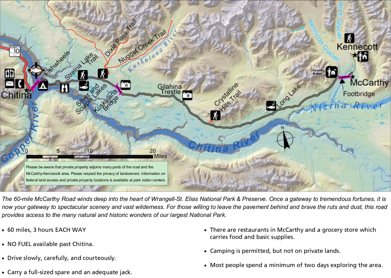
McCarthy Road map from park newspaper, zooming in on this most-visited part of the park that leads to McCarthy and Kennecott south of the Wrangell Mountains. Expect 3 hours each way.
Lizenz:
Public domain
Credit:
U.S. National Park Service (http://npmaps.com/wp-content/uploads/wrangell-st-elias-mccarthy-road-map.jpg)
Bild teilen:


Relevante Bilder

Relevante Artikel
McCarthy RoadDie McCarthy Road ist eine 97 km lange Schotterstraße im Valdez-Cordova Census Area in Alaska. Sie verläuft vom Ende des Edgerton Highways bei Chitina am Copper River in östlicher Richtung bis kurz vor McCarthy im Tal des Kennicott-Gletschers. .. weiterlesen