NASA’s Aerial Survey of Polar Ice Expands Its Arctic Reach (33040347910)
.jpg?uselang=de)
For the past eight years, Operation IceBridge, a NASA mission that conducts aerial surveys of polar ice, has produced unprecedented three-dimensional views of Arctic and Antarctic ice sheets, providing scientists with valuable data on how polar ice is changing in a warming world. Now, for the first time, the campaign will expand its reach to explore the Arctic’s Eurasian Basin through two research flights based out of Svalbard, a Norwegian archipelago in the northern Atlantic Ocean. More: <a href="http://go.nasa.gov/2ngAxX2" rel="nofollow">go.nasa.gov/2ngAxX2</a>
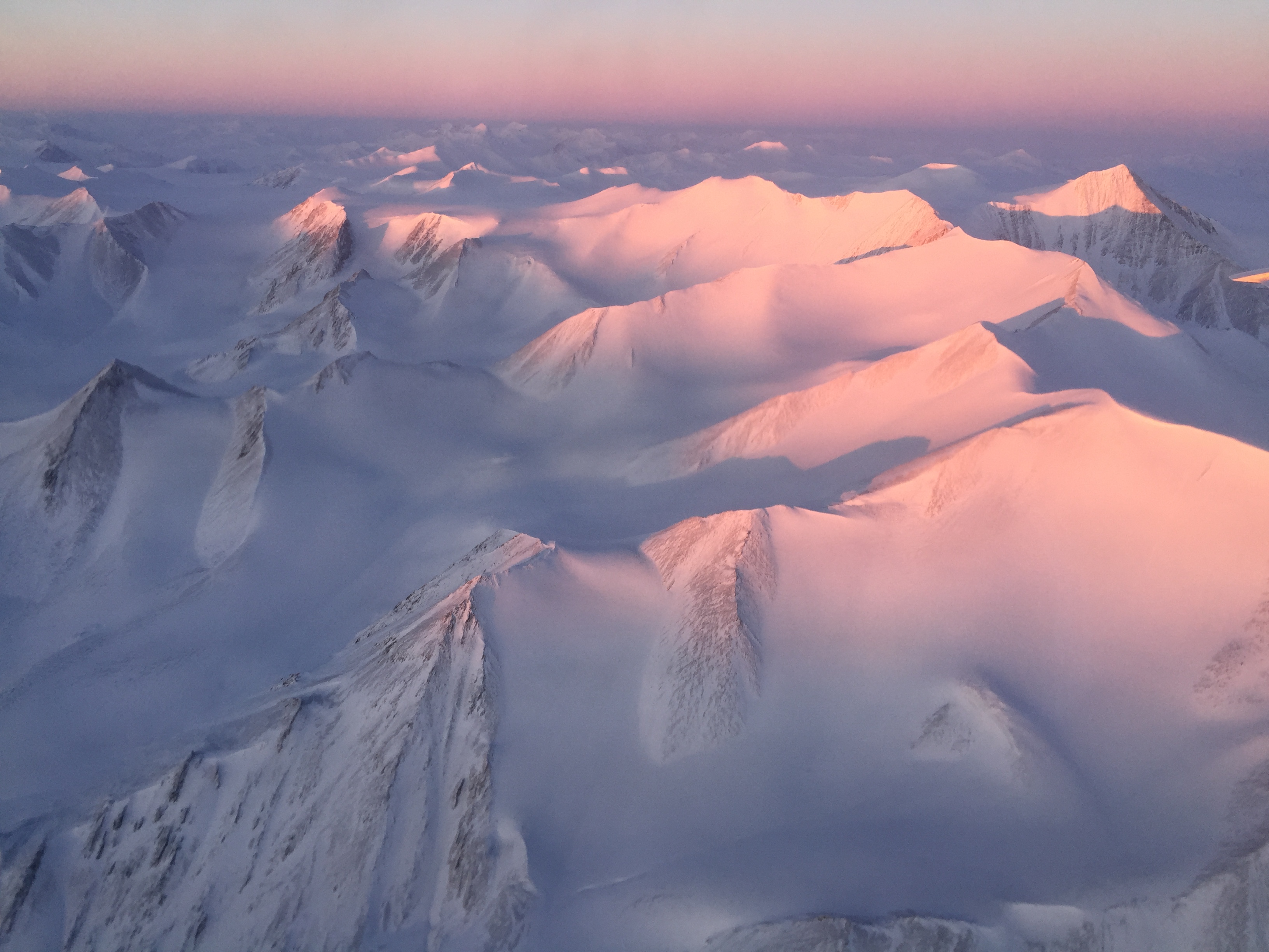
Caption: Ellesmere Island mountain tops bathed in light as the sun began to peak over the horizon during Operation IceBridge’s first flight of its 2017 Arctic campaign, on March 9, 2017. Credits: NASA/Nathan Kurtz
<a href="http://www.nasa.gov/centers/goddard/home/index.html" rel="nofollow">NASA Goddard Space Flight Center</a> enables NASA’s mission through four scientific endeavors: Earth Science, Heliophysics, Solar System Exploration, and Astrophysics. Goddard plays a leading role in NASA’s accomplishments by contributing compelling scientific knowledge to advance the Agency’s mission.
Follow us on <a href="https://twitter.com/NASAGoddardPix" rel="nofollow">Twitter</a>
Like us on <a href="http://www.facebook.com/pages/Greenbelt-MD/NASA-Goddard/395013845897?ref=tsd" rel="nofollow">Facebook</a>
Find us on <a href="http://instagrid.me/nasagoddard/?vm=grid" rel="nofollow">Instagram</a>


Relevante Bilder

_in_the_drift_ice_region_north_of_Svalbard.jpg)
.jpg)

_-_Eselspinguine.jpg)


-_Polare_Zone.png)
.jpg)


.jpg)

Relevante Artikel
PolargebietDie Polargebiete – auch polare Klimazonen oder Polarzonen genannt – sind in erster Linie eine der erdumspannenden Klimazonen, die durch bestimmte solare oder thermische Schwellenwerte abgegrenzt werden. Die beiden Polargebiete – die Arktis im Norden und die Antarktis im Süden – liegen wie zwei Kappen auf der Erde – jeweils mit einem der beiden Pole im Mittelpunkt. Ihr Rand wird nach der solaren Definition von den Polarkreisen gebildet. Richtung Äquator schließen sich die gemäßigten Zonen an – genauer: die kaltgemäßigten. Nach thermischen Parametern kommt es je nach Klimaklassifikation und Autor zu erheblichen Abweichungen von den solaren Grenzen. .. weiterlesen