Morocco CMS CC-BY (15561091658)
This is a FREE photo! Yes, all the photos in my gallery are free! :)
You can download it at full resolution (check the “all sizes” option) and do whatever you want with it: share it, adapt it and/or combine it with other material and distribute the resulting works.
Please give photo credits to “Carlos ZGZ” and put a link to this page.
I’ll be very happy to know that this photo has been useful to someone, so don’t hesitate to tell me about your use (and I will place here a link to it if you wish)! __
¡Esta es una foto LIBRE! ¡Sí, todas las fotos de mi galería son libres! :)
Puedes descargártela en plena resolución (usa la opción “all sizes”) y hacer lo que quieras con ella: compartirla tal cual, modificarla a tu gusto y/o combinarla con otro material y distribuir el resultado.
Por favor, si utilizas esta foto dale el crédito a “Carlos ZGZ” y coloca un enlace a esta página
Me hace mucha ilusión saber que una de mis fotos le ha servido a alguien. Así que si es tu caso, ¡no dudes en decírmelo! (y si quieres, pondré un enlace a tu proyecto aquí).Relevante Bilder
Relevante Artikel
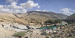
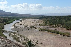
WadiEin Wadi ist ein Tal oder Flusslauf, der häufig erst nach der winterlichen Schneeschmelze oder nach starken oder länger anhaltenden Regenfällen vorübergehend Wasser führt. Zu überraschenden Sturzfluten kann es durch weit entfernte Gewitter kommen, die im entsprechend großen Einzugsgebiet des Wadi niedergehen. Der Aufenthalt in Wadis mit steilen Ufern, aber auch in sehr breiten Wadis kann in solchen Fällen lebensgefährlich werden. .. weiterlesen
Wadi DraaDas Wadi Draa ist ein regelmäßig austrocknender Fluss (Wadi) in Nordafrika mit einer (theoretischen) Länge von etwa 1100 km. Als Fluss ist er im Frühjahr nur bis Zagora erkennbar; hinter Agdz trocknet er die meiste Zeit des Jahres hindurch aus, obwohl sein Bett noch durch vereinzelte Oasen bis Mhamid wahrnehmbar bleibt. Der Draa bildete im Süden während der Protektoratszeit (1912–1956) die Grenze zu den nur dünn besiedelten Gebieten der Spanisch-Sahara; weiter östlich bildet er heute über etwa 390 km die immer noch umstrittene Grenze zu Algerien und ist – nach seltenen aber manchmal heftigen Regenfällen – der längste Fluss Marokkos. .. weiterlesen


