Mirdasid Dynasty Map
Autor/Urheber:
Attribution:
Das Bild ist mit 'Attribution Required' markiert, aber es wurden keine Informationen über die Attribution bereitgestellt. Vermutlich wurde bei Verwendung des MediaWiki-Templates für die CC-BY Lizenzen der Parameter für die Attribution weggelassen. Autoren und Urheber finden für die korrekte Verwendung der Templates hier ein Beispiel.
Shortlink:
Quelle:
Größe:
731 x 971 Pixel (153879 Bytes)
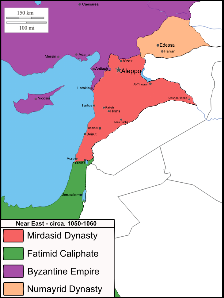
Beschreibung:
A map of Near East, circa 1050-1060, showing The Midrasid and Numayrid Dynasty, near The Byzantine Empire and The Fatimid Caliphate.
Kommentar zur Lizenz:
This file (map · collage · logo · graphic · etc.) is a part of the Project: |
This work was composed by |
Lizenz:
Bild teilen:


Relevante Bilder

Relevante Artikel
MirdasidenDie Mirdasiden waren eine muslimische Lokaldynastie und kontrollierten das Emirat Aleppo fast vollständig zwischen 1024 und 1080. .. weiterlesen