Milne bay 1942

Autor/Urheber:
US Army
Shortlink:
Quelle:
Größe:
1897 x 1461 Pixel (276120 Bytes)
Beschreibung:
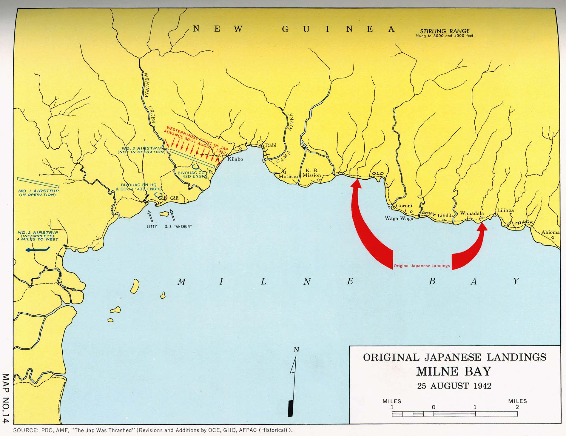
Map of the japanese landing in Milne Bay 1942
Lizenz:
Public domain
Credit:
Perry-Castañeda Library Map Collection, Engineers of the Southwest Pacific, 1941-1945, Vol. 1
Maps from "Engineers of the Southwest Pacific, 1941-1945, Vol. 1: Engineers in Theater Operations. Reports of Operations (of the) United States Army Forces in the Far East, Southwest Pacific Area, Army Forces, Pacific" by Office of the Chief Engineer, General Headquarters, Army Forces Pacific, Washington, U.S. Govt. Print. Office, 1947.
https://legacy.lib.utexas.edu/maps/historical/engineers_v1_1947/milne_bay_1942.jpg
Bild teilen:


Relevante Bilder
.svg)
.svg)

.svg)

Relevante Artikel
Schlacht um die Milne-BuchtDie Schlacht um die Milne-Bucht war eine Schlacht während des Pazifikfeldzuges im Zweiten Weltkrieg. Japanische Marineinfanterie griff am 25. August 1942 einen australischen Stützpunkt an der Milne-Bucht an der Ostspitze Neu Guineas an. Die Kämpfe dauerten bis zum Rückzug der Japaner am 5. September 1942 an. Die Schlacht war die erste Schlacht des Pazifikkrieges, bei der die alliierten Truppen die japanischen Landstreitkräfte besiegen konnten. .. weiterlesen