Mediterranean continues to bake ESA23419670

Autor/Urheber:
European Space Agency
Shortlink:
Quelle:
Größe:
3288 x 1869 Pixel (3430605 Bytes)
Beschreibung:
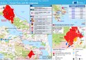
This map shows the temperature of the land surface on 2 August 2021. It is clear to see that surface temperatures in Turkey and Cyprus have reached over 50°C, again. A map we published on 2 July shows pretty much the same situation. The Mediterranean has been suffering a heatwave for some weeks, leading to numerous wildfires. Turkey, for example, is reported to be amid the country’s worst blazes in at least a decade.
The map here was generated using data from Copernicus Sentinel-3’s Sea and Land Surface Temperature Radiometer. While weather forecasts use predicted air temperatures, this satellite instrument measures the real amount of energy radiating from Earth – and dipicts the real temperature of the land surface.
The Copernicus Sentinel-3 satellites also carry camera-like instruments, which captured smoke billowing from the fires in Turkey on 30 July.
Lizenz:
Attribution
Credit:
Bild teilen:


Relevante Bilder

.jpeg)


Relevante Artikel
Hitzewelle und Waldbrände in Südeuropa und der Türkei 2021Die Hitzewelle und Waldbrände in Südeuropa und der Türkei 2021 begannen in der ersten Juliwoche 2021 in Südeuropa. Ursache der besonders großen Hitze war der Scirocco. Die Hitzewelle wird als Folge des Klimawandels diskutiert. .. weiterlesen