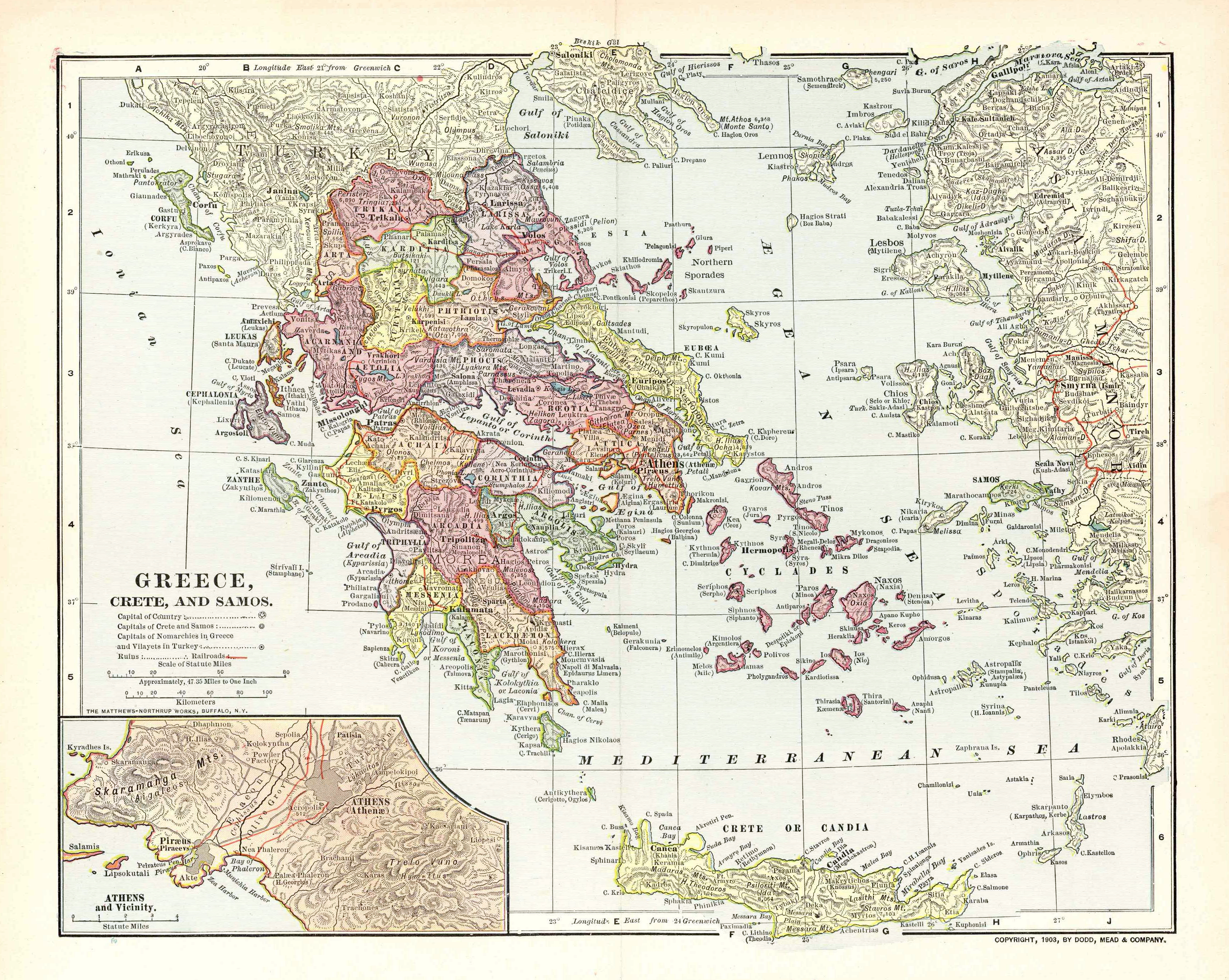
Map of Greece 1903
Autor/Urheber:
Unknown. Published by Dodd, Mead & Co. Printed by Mattheus-Northup Works, Buffalo, NY.
Shortlink:
Quelle:
Größe:
3472 x 2768 Pixel (16329431 Bytes)
Beschreibung:
Map of the Kingdom of Greece, the Cretan State and the Principality of Samos in 1903. It displays the greek railway network as it was in 1900-1901.
Kommentar zur Lizenz:
PD-US
Lizenz:
Public domain
Credit:
Old map, own collection. Übertragen aus en.wikipedia nach Commons durch Sfan00_IMG mithilfe des CommonsHelper. Original uploader was Sv1xv at en.wikipedia.
Bild teilen:


Relevante Bilder


Relevante Artikel
Politische Gliederung GriechenlandsDie politische Gliederung Griechenlands kennt mit Wirkung vom 1. Januar 2011 drei Verwaltungsebenen. .. weiterlesen