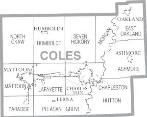
Map of Coles County Illinois
Autor/Urheber:
US Census Bureau, Cropped by uploader
Shortlink:
Quelle:
Größe:
300 x 240 Pixel (11609 Bytes)
Beschreibung:
Coles County Illinois
Kommentar zur Lizenz:
This image or file is a work of a United States Census Bureau employee, taken or made as part of that person's official duties. As a work of the U.S. federal government, the image is in the public domain.
Lizenz:
Public domain
Relevante Bilder
Relevante Artikel
Coles CountyDas Coles County ist ein County im US-amerikanischen Bundesstaat Illinois. Im Jahr 2010 hatte das County 53.873 Einwohner und eine Bevölkerungsdichte von 40,9 Einwohnern pro Quadratkilometer. Der Verwaltungssitz ist Charleston. .. weiterlesen


