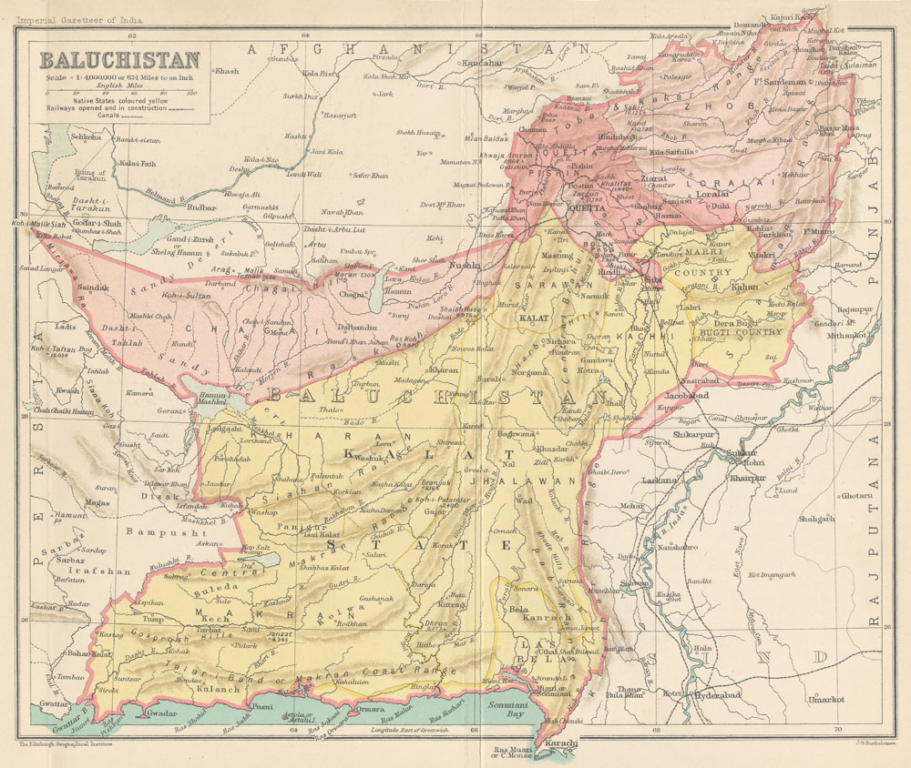
Map of Baluchistan from The Imperial Gazetteer of India (1907-1909)
Autor/Urheber:
John G. Bartholomew
Shortlink:
Quelle:
.jpg?uselang=de)
Größe:
1000 x 844 Pixel (260423 Bytes)
Beschreibung:
Map of Baluchistan from The Imperial Gazetteer of India Volume 6, opposite page 336.. New edition, published under the authority of His Majesty's Secretary of State for India in Council. Oxford: Clarendon Press, 1907-1909.
Scale: 1:6,000,000. 1 in. to 94.6 miles. Native States colored yellow.
Lizenz:
Public domain
Bild teilen:


Relevante Bilder


Relevante Artikel
KalatKalat war ein Fürstenstaat Britisch-Indiens in der heutigen pakistanischen Provinz Belutschistan. 1941 hatte das Khanat eine Fläche von 189.783 km² und 460.000 Einwohner. .. weiterlesen