Map commune FR insee code 33501
Autor/Urheber:
|
Map data (c) OpenStreetMap contributors, CC-BY-SA
• Shape files infrastructure: railway, highways, water: all originally by OpenStreetMap contributors. Status december 2011
• Label and Insee code commune: from Geofla (note that commune boundaries are also available under free license at geofla, but not near acceptable quality due to extreme simplification!)
• Data for exact commune* and department boundaries: derived via osm download geofabrik.de and osm2pgsql, OpenStreetMap contributors.
• Data for landuse: OSM / Corine land cover, 2006 ([1])
• Mentioned sources combined and exported for each commune using a script by Michiel1972
*note: shown commune boundaries are from OSM dump May 2012; at that time about 90% complete
|
Attribution:
Das Bild ist mit 'Attribution Required' markiert, aber es wurden keine Informationen über die Attribution bereitgestellt. Vermutlich wurde bei Verwendung des MediaWiki-Templates für die CC-BY Lizenzen der Parameter für die Attribution weggelassen. Autoren und Urheber finden für die korrekte Verwendung der Templates hier ein Beispiel.
Größe:
756 x 605 Pixel (72155 Bytes)
Beschreibung:
Map commune FR insee code 33501.png
Credit:
derived work, see author details
Weitere Informationen zur Lizenz des Bildes finden Sie hier. Letzte Aktualisierung: Tue, 04 Oct 2022 07:33:21 GMT
Relevante Bilder
Relevante Artikel
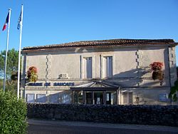
Saucats
Saucats ist eine französische Gemeinde im Département Gironde in der Region Nouvelle-Aquitaine. Die Gemeinde liegt im Einzugsgebiet der Stadt Bordeaux, etwa 30 Kilometer südlich in den sogenannten Landes de Bordeaux. Während Saucats im Jahr 1962 über 550 Einwohner verfügte, zählt man aktuell 3255 Einwohner.
.. weiterlesen


