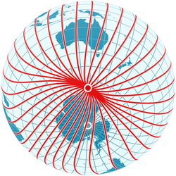
Magnetic meridian phi 30 lam -133.16 1000x1000
The magnetic meridians (not to be confused with magnetic field lines) follow the directions shown by a magnetic compass, that is, they follow the direction of the horizontal component of the field lines in the vicinity of the Earth's surface and thus show the shape of the field. The angle between the magnetic meridians (red) and the geographic meridians (blue, running precisely north-south) is the magnetic declination. The diagram demonstrates the irregularities of the Earth's magnetic field and the fact that in general compasses point neither towards the geographic north pole nor towards the magnetic north pole.
Currently (2010) the longitude of the arctic magnetic pole is -133.16°. So for all points on the geographic meridian -133.16° (shown as a red-blue line) the magnetic and the geographic pole lie in precisely the same direction. If compasses were always pointing precisely towards the magnetic pole, a compass sitting on that particular meridian would at the same time point due north, and the declination would be zero. Instead, as the diagram shows, the declination at the compass location is positive and a traveller following the compass would travel in a curved line before arriving at the magnetic pole.
The magnetic field was computed using the coefficients of the International Geomagnetic Reference Field for the epoch 2010.Relevante Bilder
Relevante Artikel
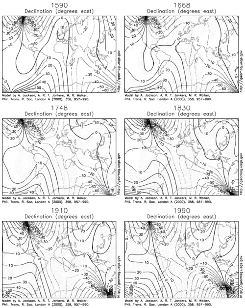
Deklination (Geographie)Deklination ist anschaulich der Winkelunterschied zwischen der am Magnetkompass angezeigten Nordrichtung und der geographischen Nordrichtung, welcher insbesondere bei der Navigation berücksichtigt werden muss. Mathematisch ausgedrückt ist die Deklination an einem Punkt der Erdoberfläche die Winkeldifferenz zwischen der Projektion des magnetischen Feldlinienvektors auf die Horizontebene und dem Meridianvektor. .. weiterlesen


