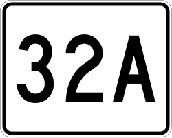
MA Route 33
This file is in the public domain because it comes from the Massachusetts Amendments to the Manual on Uniform Traffic Control Devices, sign number M1-5, which states on p. 1 that Massachusetts has adopted the federal Manual on Uniform Traffic Control Devices except for "modifications that were deemed necessary to cover local requirements and to incorporate in these official standards the most recent traffic engineering recommendations of MassDOT." The federal MUTCD states specifically on its page I-1 that:
No amendments supersede this provision of the MUTCD. |
Relevante Bilder
Relevante Artikel
Liste der State-, U.S.- und Interstate-Highways in MassachusettsDies ist eine nach ihrer Nummerierung sortierte Aufstellung von State Routes, U.S. Highways und Interstates im US-Bundesstaat Massachusetts. .. weiterlesen
Autostrada A90Die Autostrada A90, auch Autostrada del Grande Raccordo Anulare genannt, ist eine 68,2 km lange italienische Ringautobahn, die um die Hauptstadt Rom herumführt. Sie ist auf ihrer gesamten Länge mautfrei. Seit 1999 wird die Autobahn offiziell als „A90“ bezeichnet, was sich aber praktisch noch nicht durchgesetzt hat, da die Beschilderung weiterhin einzig die Abkürzung „GRA“ aufweist. .. weiterlesen
Massachusetts TurnpikeAls Massachusetts Turnpike wird das östlichste, 138,1 mi (222,3 km) lange Teilstück der Interstate 90 im Bundesstaat Massachusetts der Vereinigten Staaten bezeichnet. Der Turnpike ist teilweise mautpflichtig und beginnt an der westlichen Grenze von Massachusetts in West Stockbridge, wo er die I-90 über den Berkshire Connector mit dem New York State Thruway verbindet. Von dort verläuft die Strecke in östlicher Richtung und durch die Städte Springfield, Worcester sowie Boston, um schließlich am Logan International Airport in East Boston zu enden, wo der Turnpike auf die Massachusetts Route 1A trifft. .. weiterlesen


