M50 motorway (Ireland)
Shortlink:
Quelle:
.png?uselang=de)
Größe:
1490 x 1920 Pixel (283607 Bytes)
Beschreibung:
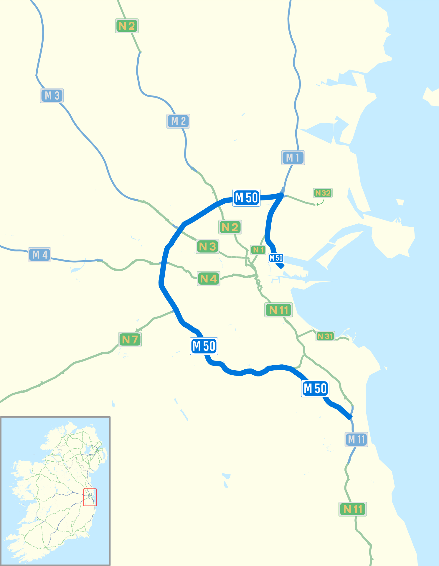
Map of M50 motorway (Ireland) and Dublin area roads with M50 blue bolded, Nxx routes in green and Mxx routes in blue
Lizenz:
Credit:
I (Sswonk (talk)) created this work entirely by myself, using Inkscape and data from http://www.openstreetmap.org/?lat=53.41&lon=-7.7&zoom=7&layers=B000FTF which was released under https://creativecommons.org/licenses/by-sa/2.0/.
Bild teilen:


Relevante Bilder


Relevante Artikel
M50 motorway (Irland)Der M50 motorway ist eine irische Autobahn, die den C-förmigen Autobahnring um Dublin bildet. Im Norden endet die Strecke am Eingang zum Dublin Port Tunnel, das südliche Ende ist am Kreuz mit der M11. Sie ist ein Teil der Europastraße 1. .. weiterlesen