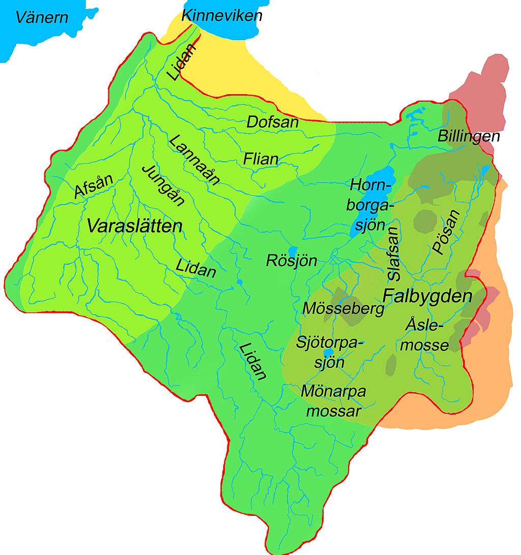
Lidans vattenområde 1-160000
Autor/Urheber:
Shortlink:
Quelle:
Größe:
1555 x 1657 Pixel (1123419 Bytes)
Beschreibung:
Map of drainage area of the river Lidan in Västergötland, Sweden. Scale circa 1:160,000. The drainage area is mostly within the former Skaraborg's County. The river and its tributaries and lakes are marked blue. The drainage area is green with a red border. In the western part of the drainage area, "Varaslätten" (i.e. "The Vara plain") is marked in yellow hue (light green within the drainage area, yellow outside). In the eastern part of the drainage area, the Falbygden area is marked in orange hue (mossgreen within the drainage area, orange outside). The table-mountains of Västergötland is surrounding the Falbygden area and are marked in dark red hue (olive green within the drainage area, dark red outside). The names are given for Lidan and its tributaries Flian, Dofsan, Slafsan, Pösan, Lannaån, Jungån, and Afsån. The names are also given for the lakes Hornborgasjön, Rösjön, and Sjötorpasjön, and also the recipient Kinneviken (a part of lake Vänern). Two bogs within the drainage area are named: Mönarpa mossar and Åsle mosse. The table mountains Billingen and Mösseberg are also named.
Lizenz:
Public domain
Relevante Artikel
LidanLidan ist ein schwedischer Fluss in der historischen Provinz von Västergötland und der heutigen Provinz von Västra Götalands län. .. weiterlesen
