Landsat ataturk 24aug02 57m
Autor/Urheber:
NASA and USDA Foreign Agricultural Service Production Estimates and Crop Assessment Division (PECAD).
Shortlink:
Quelle:
Größe:
1973 x 1480 Pixel (1706085 Bytes)
Beschreibung:
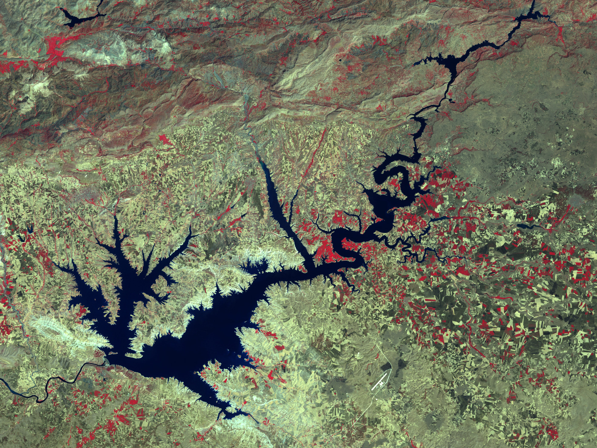
Ataturk Dam Lake after the construction of the dam. Image aquired by Landsat 7 Enhanced Thematic Mapper Plus (ETM+) instruments (ETM+ bands 4, 3, and 2).
Lizenz:
Public domain
Bild teilen:


Relevante Bilder


Relevante Artikel
Atatürk-StaudammDer Atatürk-Staudamm am Euphrat ist der erste, wichtigste und größte der 22 Staudämme des Südostanatolien-Projektes (GAP) in der Türkei. Der nach Mustafa Kemal Atatürk benannte Stausee ist etwa 1,5-mal so groß wie der Bodensee. Die Talsperre ist nach dem Schüttvolumen des Staudamms die neuntgrößte der Welt, nach Speicherraum ist sie an 22. Stelle. Die Angaben über das Datum der Fertigstellung schwanken je nach Sichtweise von 1990 bis 1995. Seit 1992 ist er in Betrieb. .. weiterlesen