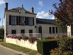
La Groutte (Cher) (12795372555)
La Groutte (Cher).
Oppidum* des Murettes.
Ce rempart de terre et de pierres long de 210 mètres et large à sa base d’environ 15 mètres, avec une hauteur moyenne de 3 mètres, encerclait l’extrémité d’un plateau calcaire dominant la vallée du Cher.
L’enclos mesurait environ 5 hectares.
Les premières traces d’occupation remontent au néolithique (3500 avant JC). L’intérieur du camp est occupé par des habitations, des cultures et le bétail. Le rempart est constitué de terre et de pierres surmonté par une palissade et protégé par un fossé.
Le vallum* sera remanié plusieurs fois:
A l’âge du bronze, le fossé est comblé avec les matériaux du premier rempart. Un deuxième fossé est creusé à l’avant et un rempart réhaussé est construit avec les matériaux du fossé et le raclage de l’intérieur du camp. Ce rempart est surmonté d’une palissade.
Vers les VIIème VIème siècles avant JC (Hallstatt moyen), un mur de pierre sèche renforcé par un noyau de chaux remplace la palissade en bois.
Âge du fer final (Tène), le mur est surélevé et un second mur parallèle construit à l’extrieur du premier à environ 6 mètres.
- Oppidum : nom donné par les romains à un lieu de refuge public.
- Vallum : fortifications de camp romain généralement composées d’un talus surmonté d’une palissade avec un fossé extérieur.
The Groutte (Cher) .
Oppidum* of Murettes.
This rampart built with earth and stones, long 210 meters wide at its base and about 15 meters, with an average height of 3 meters, encircling the end of a calcareous plateau that overlooks the valley of the Cher.
The enclosure was approximately 5 hectares.
The earliest traces of occupation dating back to the Neolithic period (3500 BC). The interior of the camp is occupied by homes, crops and animals. The wall is made of earth and stone topped by a palisade and protected by a moat.
The vallum* will be revised repeatedly:
In the Bronze Age, the ditch is filled with the materials of the first wall. A second moat is dug at the front and a greater wall is built with the materials of the ditch and scraping the inside of the camp. This wall is surmounted by a palisade.
Sixth to seventh centuries BC (Hallstatt), a dry stone wall reinforced with a core of whitewash replaces the wooden palisade.
Age of the final iron (Tene), the wall is raised and a second wall built parallel to the outside of the first approximately 6 meters.
- Oppidum: name given by the Romans to a place of refuge public.
- Vallum: fortifications Roman camp usually composed of a a side slope of earth and stone surmounted by a palisade and an outer ditch.
Relevante Bilder


Relevante Artikel
La GroutteLa Groutte ist eine französische Gemeinde mit 126 Einwohnern im Département Cher in der Region Centre-Val de Loire; sie gehört zum Arrondissement Saint-Amand-Montrond und zum Kanton Saint-Amand-Montrond. .. weiterlesen
