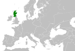
Kingdom of Scotland Map
Autor/Urheber:
Shortlink:
Quelle:
Größe:
552 x 432 Pixel (66370 Bytes)
Kommentar zur Lizenz:

|
Der Urheber gestattet jedermann jede Form der Nutzung, unter der Bedingung der angemessenen Nennung seiner Urheberschaft.
Weiterverbreitung, Bearbeitung und kommerzielle Nutzung sind gestattet. |
Namensnennung:
Rab-k and David Liuzzo
|
Lizenz:
Attribution
Credit:
Self-made. Based upon an original work forming part of the "Europe location" map series created by David Liuzzo: Image:Europe_location_SCO.png
Relevante Bilder
Relevante Artikel
Königreich SchottlandDas Königreich Schottland existierte auf dem Gebiet des heutigen Schottlands von 843 bis 1707. Es nahm das nördliche Drittel der Insel Großbritannien ein und grenzte im Süden an das Königreich England, mit welchem es sich im Act of Union von 1707 zum Königreich Großbritannien vereinigte. .. weiterlesen


