Karoo ecoregion


Relevante Bilder


.jpg)


.jpg)


.jpg)
Relevante Artikel
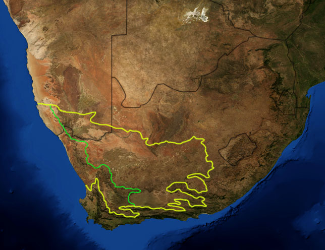
SukkulentenkarooDie Sukkulentenkaroo ist ein biogeographisches Gebiet beziehungsweise Biom im westlichen Südafrika und südwestlichen Namibia. Sie ist nach den dort häufig vorkommenden Sukkulenten benannt und beherbergt zahlreiche endemische Arten. Das Gebiet gilt als Biodiversitäts-Hotspot. .. weiterlesen
KarooDie Karoo ist eine Halbwüstenlandschaft in den Hochebenen des Landes Südafrika, nördlich der Großen Randstufe und im südlichen Namibia. Unterschieden werden Kleine Karoo, Große Karoo und Obere Karoo sowie Sukkulentenkaroo und Nama-Karoo. Mit einer Ausdehnung von 500.000 km² umfasst die Karoo fast ein Drittel des Territoriums Südafrikas. Die Sukkulentenkaroo gehört zu den Biodiversitäts-Hotspots der Erde und wird u. a. im Rahmen von BIOTA AFRICA systematisch kartiert. .. weiterlesen