Joggins regional map DE
Eigenes Werk
- Mainly created with QGIS, finalized with Adobe Illustrator and Photoshop
- Digital Elevation Model for creating the hillshade background layer (smoothened with Photoshop), hypsometric tinting, and contour lines: SRTM 1 arc second tile GeoTIFF (ID: SRTM1N45W065V3), downloaded at USGS Earth Explorer
- Rivers/brooks, lakes, places, railroad lines, and roads: a selection of Open Street Map data (created by Open Street Map contributors, 2017, distributed under the Open Data Commons Open Database License), downloaded as shapefiles at Geofabrik
- Nova Scotia and New Brunswick road sign templates:
Position and extent of the Joggins Fossil Cliffs are according to Bezanson (2006).[1] Naming of water bodies and terrain features follows various sources such as geological maps of the Nova Scotia Dept. of Mines and Energy.
Relevante Bilder
Relevante Artikel
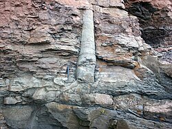
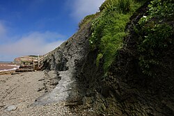
Joggins Fossil CliffsDie Joggins Fossil Cliffs sind eine der bedeutendsten Fundstellen für fossile Pflanzen und Tiere oberkarbonischer terrestrischer Ökosysteme. Sie bilden einen Teil der Kliffküste der oberen Bay of Fundy in Nova Scotia („Neuschottland“), Kanada. Seit 2008 stehen sie auf der Liste des UNESCO-Weltnaturerbes. .. weiterlesen


