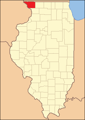
Jo Daviess Counry Illinois 1839
Autor/Urheber:
- Illinois_Locator_Map.PNG: US Census, Ruhrfisch
- derivative work: Fishal (talk)
Shortlink:
Quelle:
Größe:
288 x 405 Pixel (9973 Bytes)
Beschreibung:
Locator Map of Jo Daviess County, Illinois, 1839.
Based on: Illinois Secretary of State. Origin and Evolution of Illinois Counties. March 2010. p. 57. http://www.cyberdriveillinois.com/publications/pdf_publications/ipub15.pdf
Lizenz:
Public domain
Credit:
Relevante Bilder
Relevante Artikel
Jo Daviess CountyDas Jo Daviess County ist ein County im US-amerikanischen Bundesstaat Illinois. Im Jahr 2010 hatte das County 22.678 Einwohner und eine Bevölkerungsdichte von 14,6 Einwohnern pro Quadratkilometer. Der Verwaltungssitz ist Galena. .. weiterlesen


