Irina Mar 1 2012 0715Z
The Moderate Resolution Imaging Spectroradiometer (MODIS) on NASA’s Terra satellite captured this natural-color image on March 1, 2012. The storm appears to feature a tightly coiled center surrounded by large spiral arms. Clouds cover most of Madagascar.
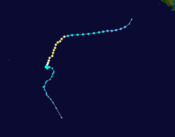
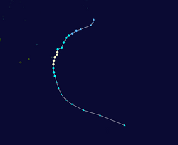
As of March 1, the JTWC reported, Irina was located roughly 185 nautical miles (345 kilometers) southwest of Antananarivo and was moving southward. The storm was forecast to take a more westward trajectory across the Mozambique Channel over the next couple days.Relevante Bilder
Relevante Artikel
Zyklonsaison im Südwestindik 2011–2012Die Zyklonsaison im Südwestindik 2011–2012 begann offiziell am 15. November 2011 und endet am 30. April 2012, mit Ausnahme von Mauritius und den Seychellen, wo sie erst am 15. Mai 2012 endet. Diese Daten begrenzen konventionell die Zeit des meteorologischen Jahres der Südhalbkugel, in denen sich im südwestlichen Indik die meisten tropischen Wirbelstürme bilden. Das erste tropische System bildete sich am 5. Dezember 2011. Die tropischen Wirbelstürme in diesem Becken werden durch das Regional Specialized Meteorological Centre (RSMC) in La Réunion, Frankreich überwacht. Das Verantwortungsgebiet von Météo-France umfasst den Indischen Ozean südlich des Äquators und westlich von 90° östlicher Länge. Tropische Wirbelstürme in diesem Bereich werden Zyklone genannt. Das Joint Typhoon Warning Center (JTWC) in Honolulu beobachtet ebenfalls das Wettergeschehen in diesem Seegebiet; es gibt Sturmwarnungen aus, die sich primär an Einrichtungen der Streitkräfte der Vereinigten Staaten im Indischen Ozean richten. .. weiterlesen


