Hidaka Mountains modified
Autor/Urheber:
- Hidaka_Mountains_ISS006-E-29797.jpg: created by NASA
- derivative work: Bulwersator (talk)
Shortlink:
Quelle:
Größe:
3032 x 2064 Pixel (842904 Bytes)
Beschreibung:
Info
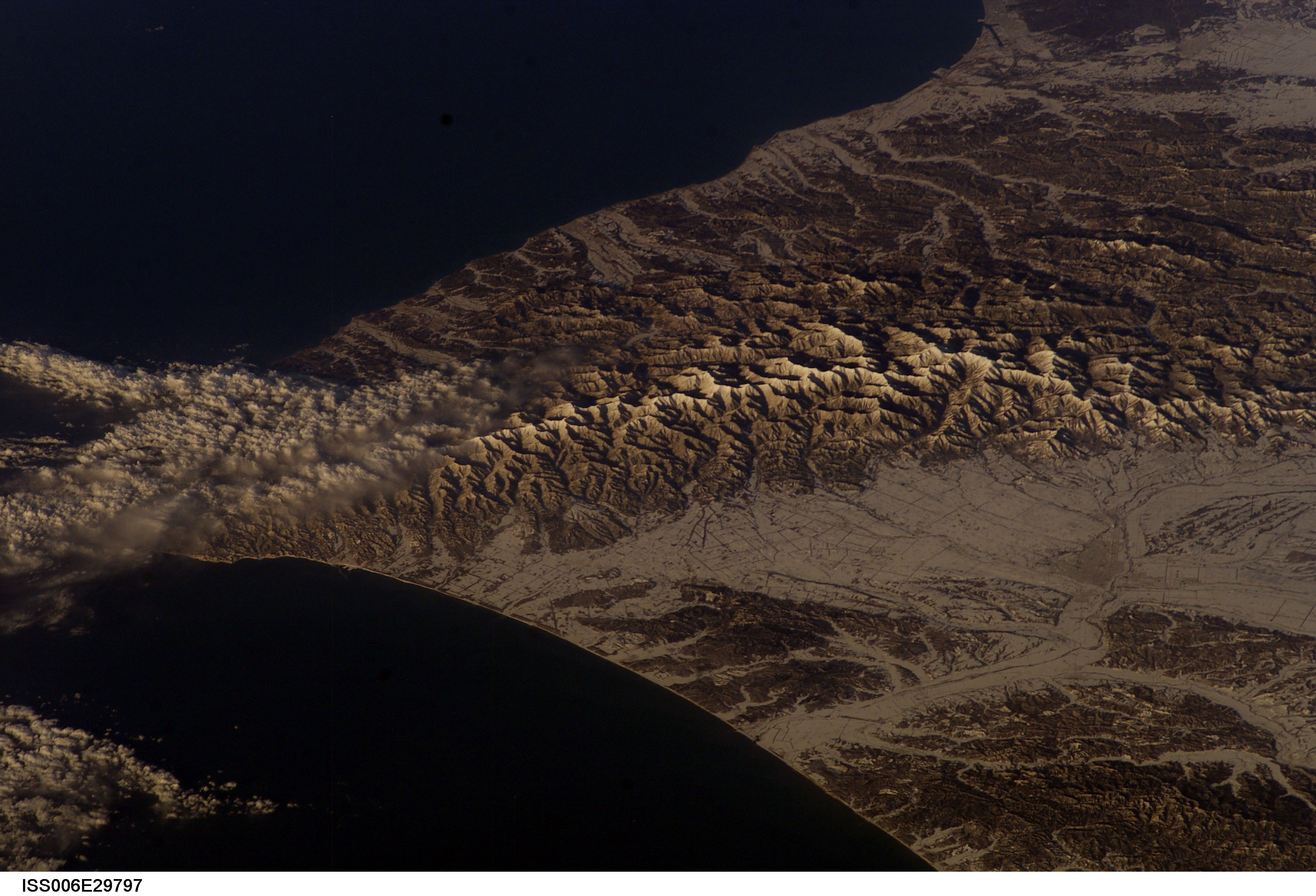
HOKKAIDO, HIDAKA MOUNTAINS, taken from the International Space Station at 13:33:49 JST on Feb. 22, 2003.
- URL: http://eol.jsc.nasa.gov/scripts/sseop/photo.pl?mission=ISS006&roll=E&frame=29797
- This file is in the public domain because it was created by NASA.
Identification
- Mission: ISS006 Roll: E Frame: 29797 Mission ID on the Film or image: ISS006
- Country or Geographic Name: JAPAN
- Features: HOKKAIDO, HIDAKA MOUNTAINS
- Center Point Latitude: 42.5 Center Point Longitude: 143.0 (Negative numbers indicate south for latitude and west for longitude)
- Stereo: (Yes indicates there is an adjacent picture of the same area)
- ONC Map ID: JNC Map ID:
Camera
- Camera Tilt: High Oblique
- Camera Focal Length: 180mm
- Camera: E4: Kodak DCS760C Electronic Still Camera
- Film: 3060E : 3060 x 2036 pixel CCD, RGBG array.
Quality
- Film Exposure:
- Percentage of Cloud Cover: 10 (0-10)
Nadir
- Date: 20030222 (YYYYMMDD)GMT Time: 223349 (HHMMSS)
- Nadir Point Latitude: 44.2, Longitude: 153.2 (Negative numbers indicate south for latitude and west for longitude)
- Nadir to Photo Center Direction: West
- Sun Azimuth: 125 (Clockwise angle in degrees from north to the sun measured at the nadir point)
- Spacecraft Altitude: 212 nautical miles (393 km)
- Sun Elevation Angle: 18 (Angle in degrees between the horizon and the sun, measured at the nadir point)
- Orbit Number: 318
Lizenz:
Public domain
Bild teilen:


Relevante Bilder

Relevante Artikel
Hidaka-GebirgeDas Hidaka-Gebirge ist ein Gebirgszug im südwestlichen Hokkaidō in Japan. Es erstreckt sich 150 km vom Karikachi-Pass in Zentral-Hokkaidō südwärts, bis es am Kap Erimo ins Meer übergeht. Das Gebirge bildet die Grenze zwischen den Unterpräfekturen Hidaka und Tokachi. .. weiterlesen