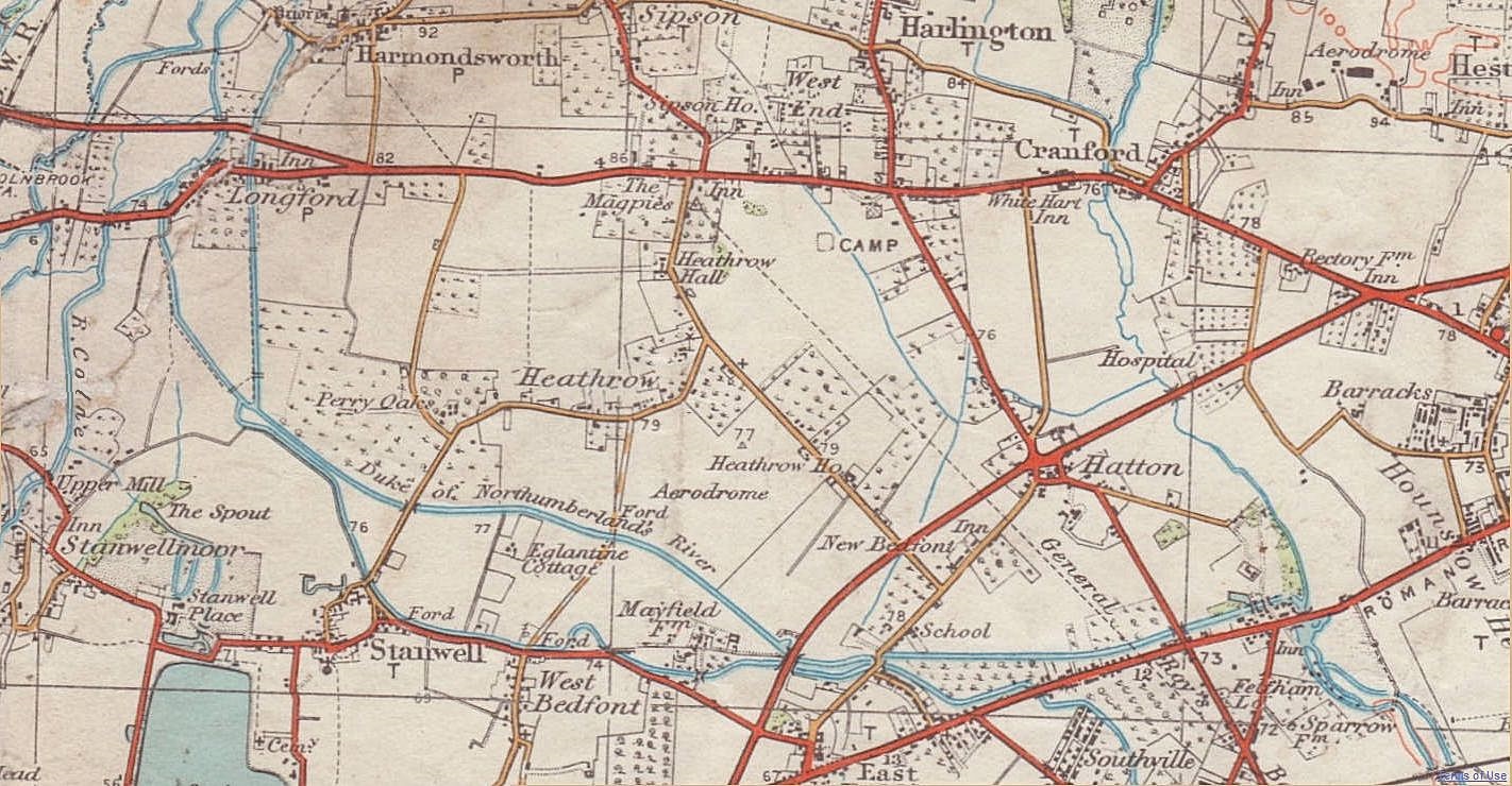
Heathrow Before World War II Map
Shortlink:
Quelle:
Größe:
1422 x 740 Pixel (407901 Bytes)
Lizenz:
Bild teilen:


Relevante Bilder


(c) Thomas Nugent, CC BY-SA 2.0

(c) Ben Brooksbank, CC BY-SA 2.0

(c) Thomas Nugent, CC BY-SA 2.0

(c) Peter Church, CC BY-SA 2.0
_by_Richard_Wilson%2c_London_Heathrow_Terminal_2%2c_UK_-_20150621-01.jpg)

(c) Maxwell Hamilton, CC BY-SA 3.0


.jpg)

Contains Ordnance Survey data © Crown copyright and database right, CC BY-SA 3.0


.jpg)


Relevante Artikel
Flughafen London HeathrowDer Flughafen London Heathrow ist der größte der sechs internationalen Verkehrsflughäfen der britischen Hauptstadt London. Er ist mit 61.600.000 Passagieren im Jahr 2022 der zweitgrößte Flughafen Europas sowie der achtgrößte weltweit. Heathrow liegt am westlichen Stadtrand im London Borough of Hillingdon und dient als Drehkreuz für die Fluggesellschaften British Airways und Virgin Atlantic. .. weiterlesen