Hauts-de-Seine department relief location map
Shortlink:
Quelle:
Größe:
823 x 1389 Pixel (233923 Bytes)
Beschreibung:
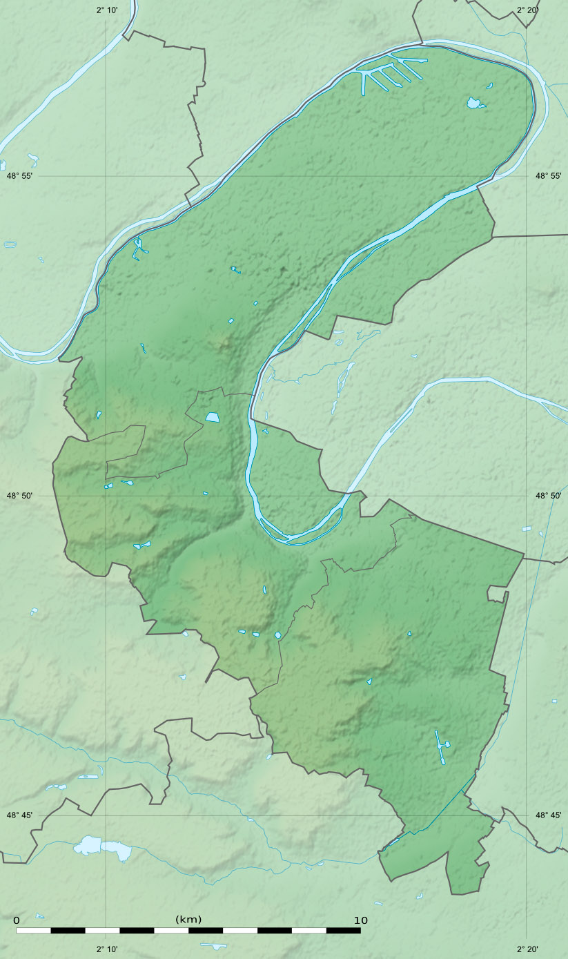
Blank physical map of the department of the Hauts-de-Seine, France, as in January 2015, for geo-location purpose, with distinct boundaries for departments and arrondissements.
Kommentar zur Lizenz:
| Attribution and Share-Alike required |
|---|
| Any use of this map can be made as long as you credit me (Eric Gaba – Wikimedia Commons user: Sting) as the author and distribute the copies and derivative works under the same license(s) that the one(s) stated below. A message with a reply address would also be greatly appreciated. |
Lizenz:
Credit:
Eigenes Werk
- Sources of data:
- NASA Shuttle Radar Topography Mission (SRTM1) (public domain);
- BD Carthage 2013 (open license) created by the IGN and available on Sandre's site;
- NASA Shuttle Radar Topography Mission (SRTM1) (public domain);
- References for the boundaries:
Bild teilen:


Relevante Bilder


Relevante Artikel
Île de la JatteDie Île de la Jatte oder Île de la Grande Jatte ist eine französische Flussinsel in der Seine. Sie liegt im Département Hauts-de-Seine zwischen den Gemeinden Neuilly-sur-Seine und Levallois-Perret auf der rechten Seite der Seine und Courbevoie auf der linken Seite. Der südliche Teil der Insel gehört zu Neuilly, der nördliche zu Levallois. .. weiterlesen