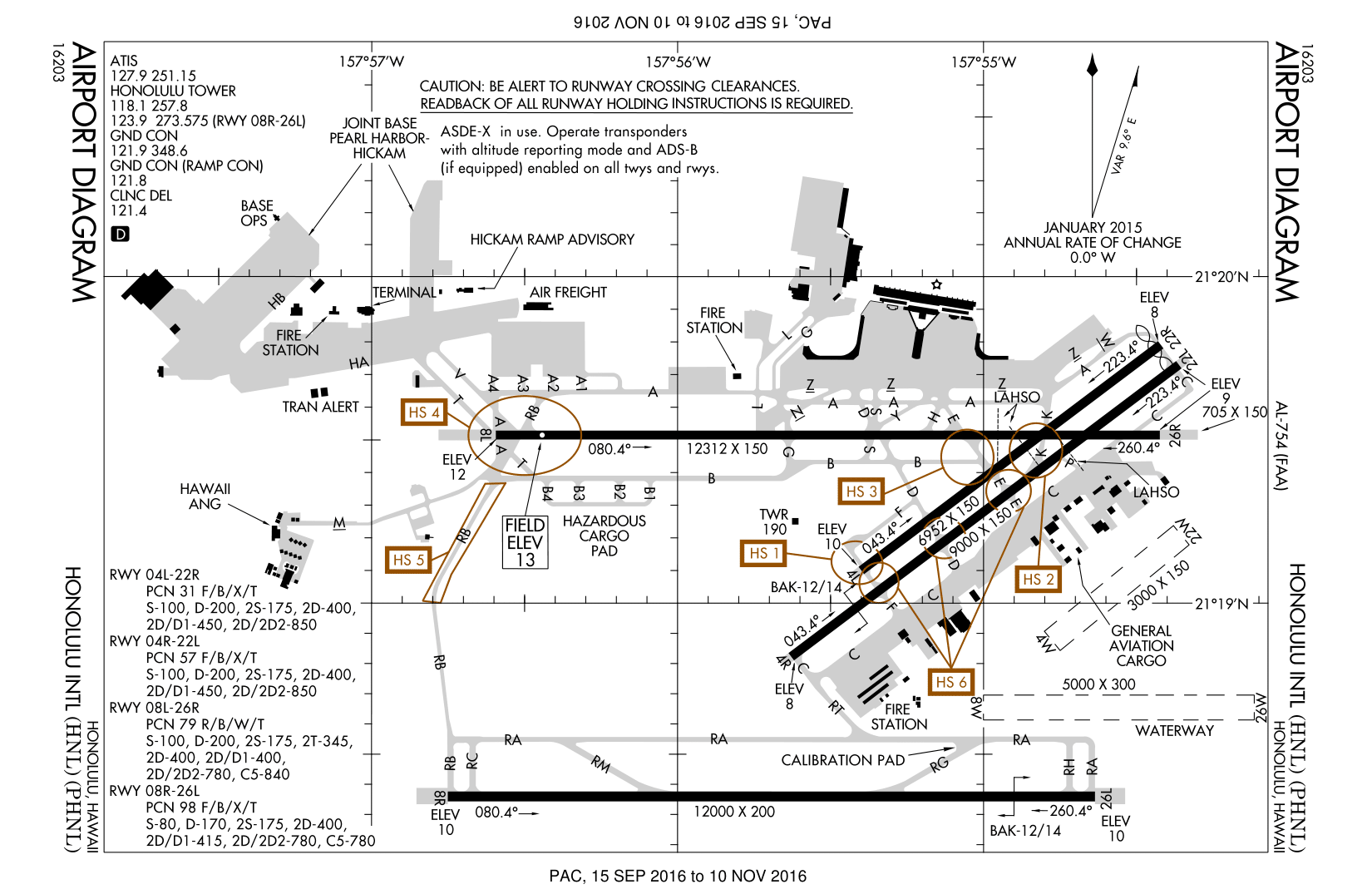
HNL - FAA airport diagram
Autor/Urheber:
Produced by the National Aeronautical Charting Office (NACO), a department of the Federal Aviation Administration (FAA).
Shortlink:
Quelle:
Größe:
1650 x 1075 Pixel (171563 Bytes)
Beschreibung:
FAA airport diagram for Honolulu International Airport (HNL) in Honolulu, Hawaii, United States.
Kommentar zur Lizenz:
Public domain.
Lizenz:
Public domain
Credit:
http://www.naco.faa.gov/d-tpp/0510/00754AD.PDF
Note: this URL changes every 28 days; the airport article should contain a link to the current FAA diagram.
Note: this URL changes every 28 days; the airport article should contain a link to the current FAA diagram.
Bild teilen:


Relevante Bilder


Relevante Artikel
Daniel K. Inouye International AirportDer Daniel K. Inouye International Airport ist der Hauptflughafen von Honolulu. Er liegt auf der Insel Oʻahu (Hawaii). Honolulu ist ein wichtiger Knotenpunkt im Pazifik zwischen Asien und den USA. Er verfügt über sechs Start- und Landebahnen, zwei davon für Wasserflugzeuge, die auch von der Joint Base Pearl Harbor-Hickam als Militärflugplatz genutzt werden. .. weiterlesen