Gila NF Wilderness Map
Autor/Urheber:
USFS
Shortlink:
Quelle:
Größe:
541 x 700 Pixel (85029 Bytes)
Beschreibung:
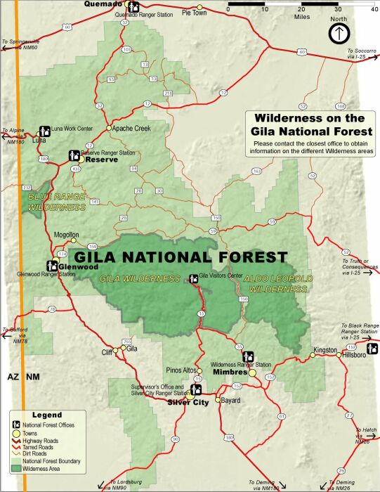
Map of the Gila National Forest (light green), with designated wilderness areas (dark green) — located in southwestern New Mexico.
- Includes the large Gila Wilderness area, in the Mogollon Mountains.
Kommentar zur Lizenz:
|
This image is a work of the Forest Service of the United States Department of Agriculture. As a work of the U.S. federal government, the image is in the public domain.
|
|
Lizenz:
Public domain
Credit:
US Forest Service[1]
Bild teilen:


Relevante Artikel
Gila National ForestDer Gila National Forest ist ein Nationalforst der Vereinigten Staaten, der im südwestlichen New Mexico liegt. Er grenzt im Westen an den Apache-Sitgreaves National Forest, der im benachbarten Staat Arizona liegt. Er umfasst 13.454 Quadratkilometer, wovon 88 % als Waldland klassifiziert sind. Der ganzjährig wasserführende Gila River durchfließt Teile des Gila National Forest. .. weiterlesen