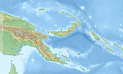
Garove Island


Autor/Urheber:
NASA Landsat7 image (worldwind.arc.nasa.gov)
Größe:
640 x 422 Pixel (40761 Bytes)
Beschreibung:
The most prominent feature of Garove Island, located north of New Britain, is a 5-km-wide caldera that is flooded by the sea through a narrow breach on the southern side of the island, forming Johann Albrecht harbor. Satellitic cones were constructed along the NE and SW coasts of the 12-km-wide island. No historical eruptions are known from Garove (also known as Vitu, or Witu), but the preservation of fresh lava flow structures on the NW coast suggests an age as young as a few hundred years. The eastern tip of Mundua Island is visible at the upper left.
Lizenz:
Public domain
Bild teilen:
Facebook   Twitter   Pinterest   WhatsApp   Telegram   E-Mail
Weitere Informationen zur Lizenz des Bildes finden Sie hier. Letzte Aktualisierung: Tue, 14 Nov 2023 00:19:24 GMT

Relevante Bilder


Relevante Artikel

Garove

Garove ist eine papua-neuguineische Vulkaninsel im Bismarck-Archipel, nördlich von Neubritannien, Provinz West New Britain. Garove ist die Hauptinsel, die zu den Vitu-Inseln gehört. Die 12 km lange Insel umschließt eine vom Ozean geflutete Caldera von 5 km Durchmesser, die über eine schmale Durchfahrt auf der Südseite der Insel erreicht werden kann und den bis zu 140 m tiefen Johann-Albrecht-Hafen bildet und der Insel einen hufeisenförmigen Grundriss verleiht. Die Wände der Caldera ragen 100 m bis 350 m steil über das Niveau des Meeresspiegels empor. Es sind keine Eruptionen aus geschichtlichen Aufzeichnungen bekannt, der Zustand der Lava-Fließstrukturen an der Nordwestküste lässt jedoch auf ein Alter von einigen hundert Jahren schließen. .. weiterlesen