Fort Peck Dam (Fort Peck Montana) 1986 01
Autor/Urheber:
US Army Corps of Engineers, Photographed by Robert Etzel
Shortlink:
Quelle:
_1986_01.jpg?uselang=de)
Größe:
1397 x 693 Pixel (796246 Bytes)
Beschreibung:
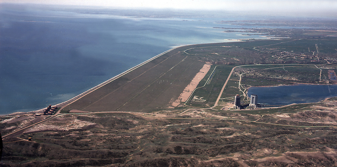
Aerial view of Fort Peck Dam, showing both powerhouses and dam. Missouri River, Fort Peck, Montana.
Kommentar zur Lizenz:
This image or file is a work of a U.S. Army Corps of Engineers soldier or employee, taken or made as part of that person's official duties. As a work of the U.S. federal government, the image is in the public domain.
Lizenz:
Public domain
Bild teilen:


Relevante Bilder
_Spillway_01.jpg)


Relevante Artikel
Fort Peck LakeDer Fort Peck Lake ist ein Stausee am Fort Peck Dam, der höchsten von sechs Talsperren am Missouri in Montana, USA. Er liegt bei der Kleinstadt Fort Peck, einem alten Handelsposten aus den 1860er Jahren, 32 km südöstlich von Glasgow, Montana, und 16 km südwestlich von Nashua. .. weiterlesen