Fort Henry to Fort Donelson
(c) Hlj in der Wikipedia auf Englisch, CC BY 3.0
Autor/Urheber:
Drawn in Adobe Illustrator CS5 by Hal Jespersen (Hlj in der Wikipedia auf Englisch)
Shortlink:
Quelle:
Größe:
6000 x 3600 Pixel (7648820 Bytes)
Beschreibung:
This map shows the approach of the union troops to Fort Donelson beginning with the attack of Fort Henry
Kommentar zur Lizenz:
Lizenz:
Credit:
Übertragen aus en.wikipedia nach Commons.; Graphic source file is available at http://www.posix.com/CWmaps/Fort_Henry_to_Fort_Donelson.png
Relevante Bilder


(c) Map by Hal Jespersen, www.posix.com/CW, CC BY 3.0

(c) Map by Hal Jespersen, www.posix.com/CW, CC BY 3.0

(c) Map by Hal Jespersen, www.posix.com/CW, CC BY 3.0


Relevante Artikel
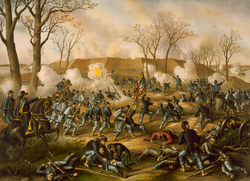
Schlacht um Fort DonelsonDie Schlacht um Fort Donelson war eine Schlacht auf dem westlichen Kriegsschauplatz des Amerikanischen Bürgerkrieges, die vom 12. bis zum 16. Februar 1862 in der Nähe der Kleinstadt Dover, Tennessee stattfand. Die Einnahme Fort Donelsons öffnete den Cumberland als Einfallsroute der Union für eine Invasion des Südens und zwang die Konföderierten, Teile von Tennessee und Kentucky aufzugeben, darunter auch die Hauptstadt Nashville. .. weiterlesen
