Fonuafoon tonga 1928

Autor/Urheber:
Autor/-in unbekannt
Shortlink:
Quelle:
Größe:
633 x 658 Pixel (100260 Bytes)
Beschreibung:
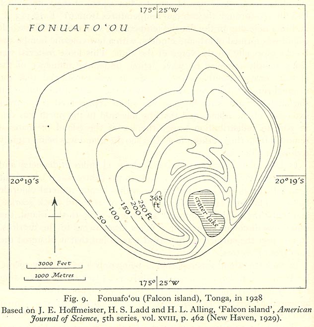
1928 map of Fonuafoʻou Island, a periodically existing island in the west of the Haʻapai Group, Tonga, Pacific Ocean
Kommentar zur Lizenz:
"Most of the maps scanned by the University of Texas Libraries and served from this web site are in the public domain. No permissions are needed to copy them. You may download them and use them as you wish. A few maps are copyrighted, and are clearly marked as such."
Lizenz:
Public domain
Credit:
Bild teilen:


Relevante Bilder


Relevante Artikel
FonuafoʻouFonuafoʻou oder Fonuafoou, anderer Name Falcon Island, auch bekannt als „Die verschwundene Insel“, ist eine kurzlebige, unbeständige Vulkaninsel in der Haʻapai-Inselgruppe im Südpazifik, die zum Königreich Tonga gehört. Sie liegt 63 km westlich der Insel Nomuka und 24 km nördlich von Hunga Tonga, der nächstgelegenen Insel. Der in Europa gebräuchliche Name „Falcon Island“ geht auf das britische Kriegsschiff H.M.S Falcon der Australia Station zurück, dessen Besatzung 1865 an dieser Stelle eine Untiefe vermaß. .. weiterlesen