Fictional Map With Romer
Autor/Urheber:
GRAHAMUK in der Wikipedia auf Englisch
Shortlink:
Quelle:
Größe:
600 x 604 Pixel (70465 Bytes)
Beschreibung:
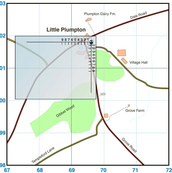
Fictional map showing use of Romer - drawn by the author (GRAHAMUK)
This map was made to go with the article Romer, but may have other uses. It loosely follows the conventions of the Ordnance Survey, but is a fictional place drawn from scratch and does not contravene any copyrights of the OS or anyone else.
Lizenz:
Credit:
Bild teilen:


Relevante Bilder

Relevante Artikel
GitternetzAls Gitternetz bezeichnet man in der Geometrie, Geografie und Kartografie ein Netz aus sich in der Regel im gleichen Abstand und meist rechtwinklig schneidenden Linien (Gitternetzlinien). Es kann einen Kartennetzentwurf abbilden oder ein gesondertes Suchgitter. .. weiterlesen