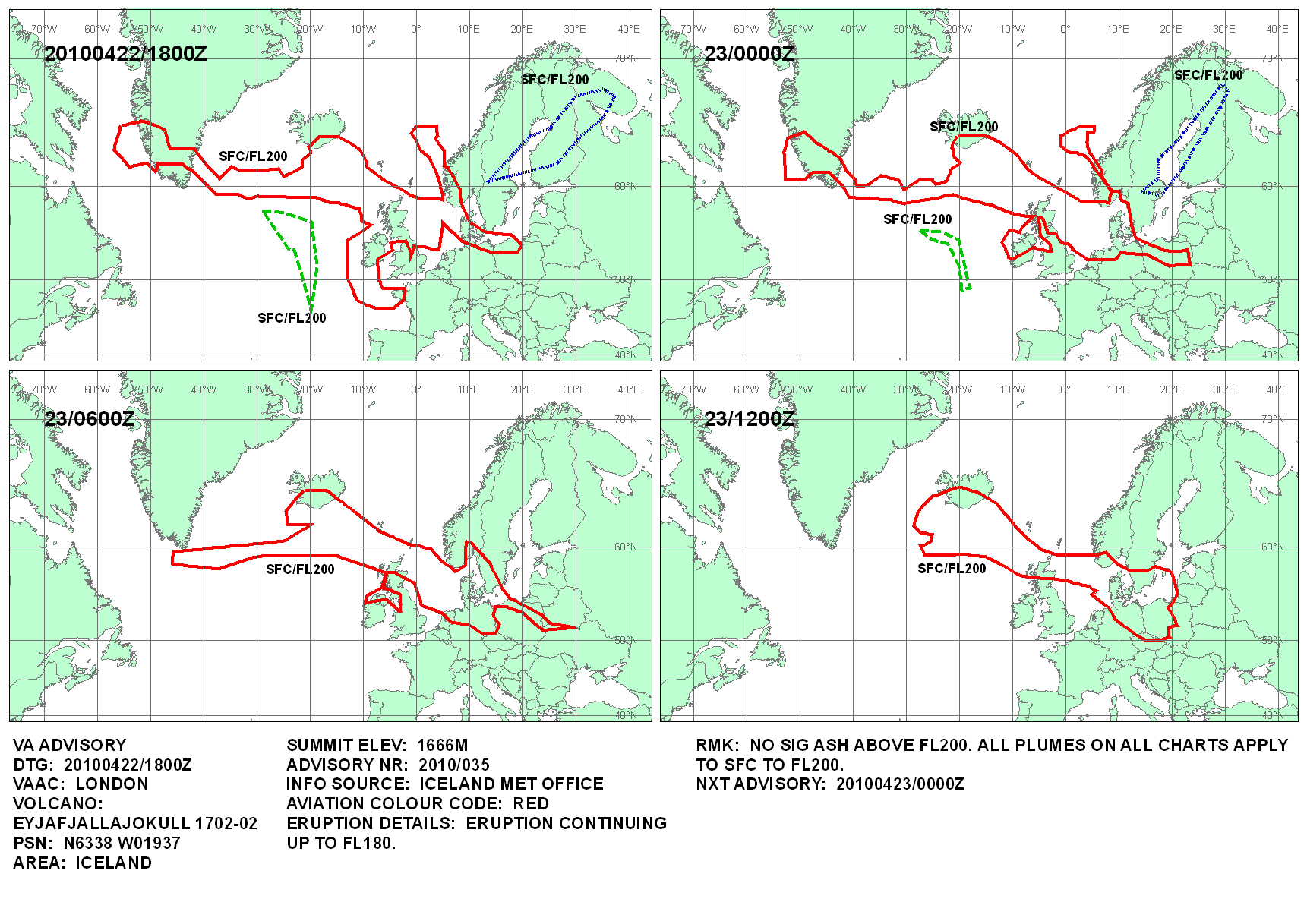
Eyjafjallajökull volcanic ash 22 April 2010

- Blankmap-ao-090N-north_pole.xcf: Reisio
- derivative work: Cogiati (talk)
This map shows the Icelandic volcanic ash cloud that closed European air space as of 22 April 2010 at 18:00 UTC. Based on http://www.metoffice.gov.uk/aviation/vaac/data/VAG_1271961522.png
Updates: http://www.metoffice.gov.uk/aviation/vaac/vaacuk_vag.html
Editable XCF version: File:Eyjafjallajökull volcanic ash 22 April 2010.xcf
Editable XCF: File:Eyjafjallajökull volcanic ash multilayer.xcf
Previous map: http://commons.wikimedia.org/wiki/File:Eyjafjallaj%C3%B6kull_volcanic_ash_21_April_2010.png


Relevante Bilder


_ILA_2010_144.jpg)


Relevante Artikel
Ausbruch des Eyjafjallajökull 2010Der Ausbruch des Vulkan-Systems Eyjafjallajökull im Jahr 2010 fand in den Monaten März bis Mai an zwei etwa 8 km voneinander entfernten Stellen statt. Die ersten Eruptionen gab es am 20. März am Fimmvörðuháls, und am 14. April am Rande der Gipfel-Caldera. Weitere Eruptionen, in deren Folge erhebliche Asche-Mengen in die Atmosphäre geschleudert wurden, ereigneten sich bis zum 24. Mai. Dampfwolken über den Vulkanen bildeten sich noch bis zum Juli 2010. .. weiterlesen