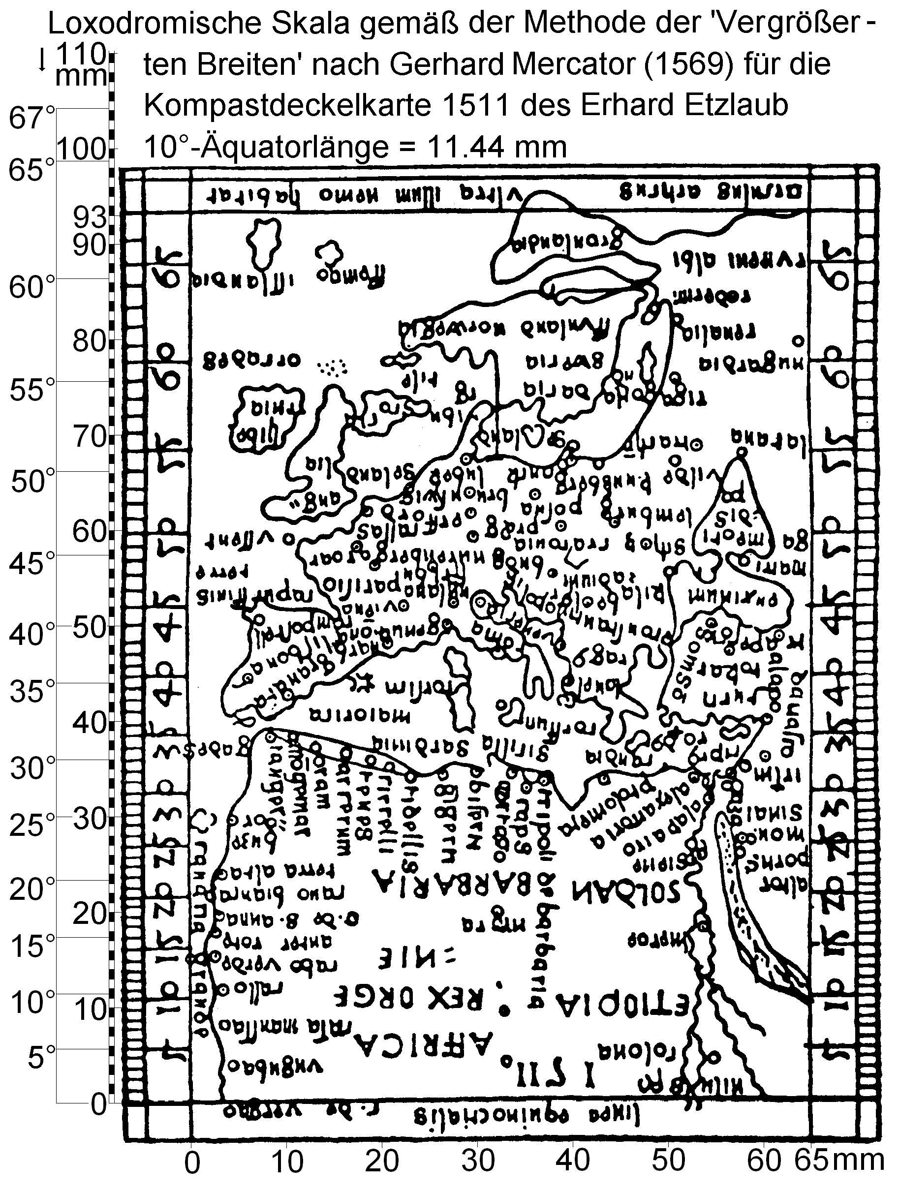
Erhard Etzlaub 1511 Sundial miniature map
Autor/Urheber:
Shortlink:
Quelle:
Größe:
1827 x 2423 Pixel (1600756 Bytes)
Beschreibung:
Miniature map from outside of hinged lid of Etzlaub's 1511 sundial. Size is 93x65 mm, orientation is "South-up", no longitudes are given. Latitudes printed in grey numbers (see right margin) were calculated by Krücken (2004, see "Source") for a Mercator projection of same area and prove that Etzlaub's approach was completely different.
These maps were designed to adjust sundials (called "Kompast" [sic!] in late medieval German) for user's latitude. Instructions were given by Etzlaub in Codex ad Compastum Norembergensem which was kept by Staatsbibliothek, Munich, Germany, but seems lost.
These maps were designed to adjust sundials (called "Kompast" [sic!] in late medieval German) for user's latitude. Instructions were given by Etzlaub in Codex ad Compastum Norembergensem which was kept by Staatsbibliothek, Munich, Germany, but seems lost.
Kommentar zur Lizenz:
PD-Art
Lizenz:
Public domain
Bild teilen:


Relevante Bilder


.jpg)
Relevante Artikel
Erhard EtzlaubErhard Etzlaub war Astronom, Kartograf, „Kompassbauer“ und Doktor der Medizin. .. weiterlesen