Durian 2006 track
Autor/Urheber:
Shortlink:
Quelle:
Größe:
2700 x 1669 Pixel (3133093 Bytes)
Beschreibung:
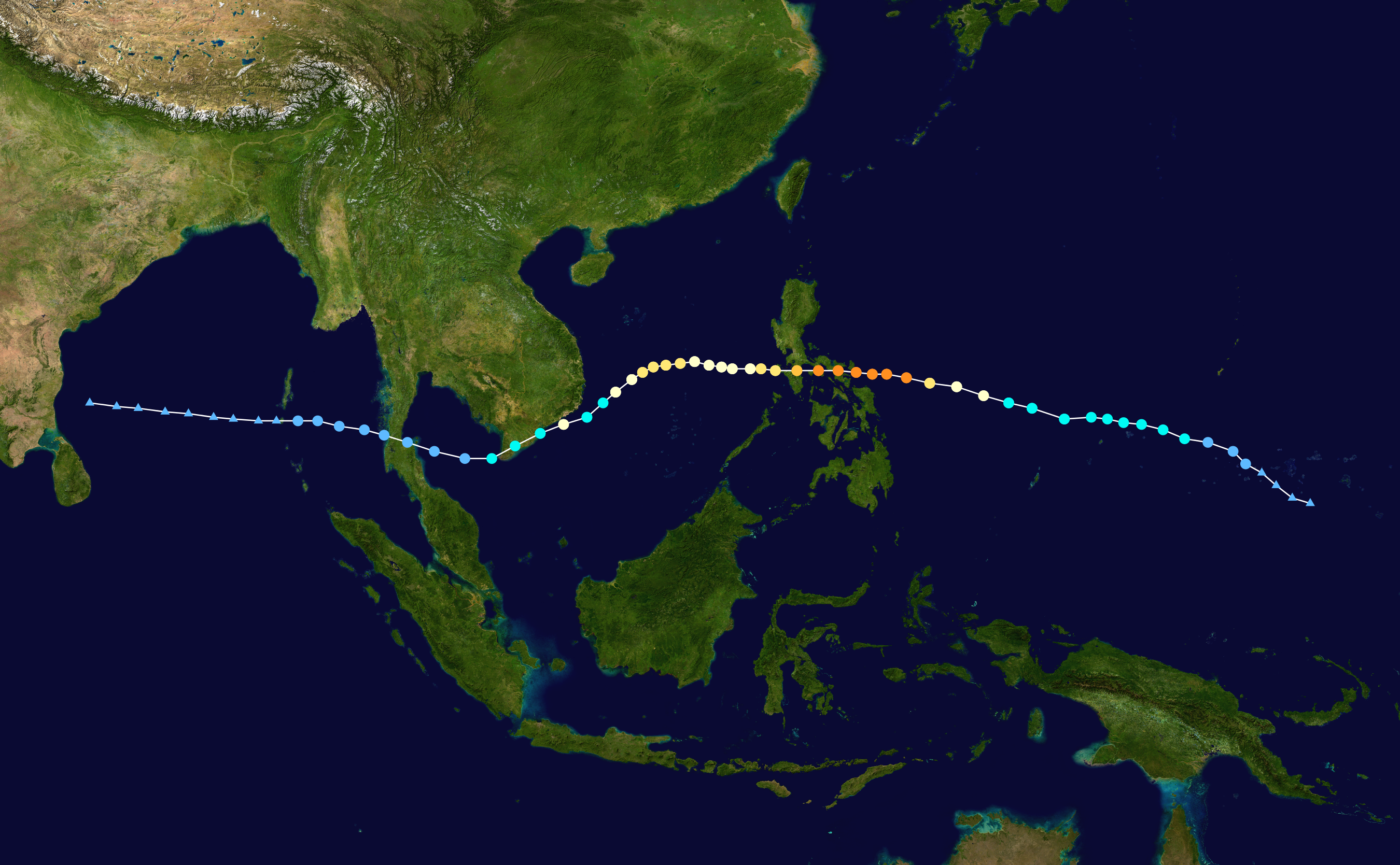
Track map of Typhoon Durian of the 2006 Pacific typhoon season. The points show the location of the storm at 6-hour intervals. The colour represents the storm's maximum sustained wind speeds as classified in the (see below), and the shape of the data points represent the nature of the storm, according to the legend below.
 Extratropical cyclone / Remnant low / Tropical disturbance / Monsoon depression
Tropical depression (≤38 mph, ≤62 km/h)
Tropical storm (39–73 mph, 63–118 km/h)
Category 1 (74–95 mph, 119–153 km/h)
Category 2 (96–110 mph, 154–177 km/h)
Category 3 (111–129 mph, 178–208 km/h)
Category 4 (130–156 mph, 209–251 km/h)
Category 5 (≥157 mph, ≥252 km/h)
Unknown
Storm type
Lizenz:
Public domain
Credit:
Created by Ajm81 using Wikipedia:WikiProject Tropical cyclones/Tracks. The background image is from NASA. Tracking data is from the Joint Typhoon Warning Center[1].
Bild teilen:


Relevante Bilder


Relevante Artikel
Taifun DurianDer Taifun Durian, auf den Philippinen als Taifun Reming bekannt, war ein tödlicher tropischer Wirbelsturm, der auf den Philippinen Verwüstung anrichtete und später Ende November 2006 die malaiische Halbinsel überquerte und massive Todesopfer forderte, als Schlammlawinen des Vulkans Mayon viele Dörfer begruben. .. weiterlesen