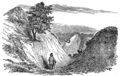
Devil's Dyke and the July Course, Newmarket - geograph.org.uk - 189834
(c) Bob Jones, CC BY-SA 2.0
Autor/Urheber:
Shortlink:
Quelle:
Größe:
640 x 427 Pixel (61546 Bytes)
Beschreibung:
Devil's Dyke and the July Course, Newmarket. The Devil's Dyke, a designated SSSI, stretches in a near perfect straight line for 12 km from the Fen edge at Reach, across the open chalk landscape near Newmarket and towards the more wooded landscape on the clay ridges, ending at Ditton Green. It reaches to around 4 metres below present ground level and up to 6 metres above. Although privately-owned, a public footpath runs along its length. Here, the Dyke runs adjacent to the July Course at Newmarket.
Lizenz:
Credit:
From geograph.org.uk
Relevante Bilder
Relevante Artikel
Devil’s Dyke (Cambridgeshire)Der Devil’s Dyke ist ein aus dem 5. oder 6. Jahrhundert stammendes Erdwerk in der englischen Grafschaft Cambridgeshire. Er besteht aus einem 12,1 Kilometer langen Erdwall mit einem Graben, der sich von Reach in südöstliche Richtung bis nach Woodditton erstreckt. Beim Devil’s Dyke handelt es sich um einen der größten und am besten erhaltenen Erdwälle in England. Es wird davon ausgegangen, dass er von den Angelsachsen errichtet wurde. .. weiterlesen


