Cyclone Gamede 25 February 2007 0950Z
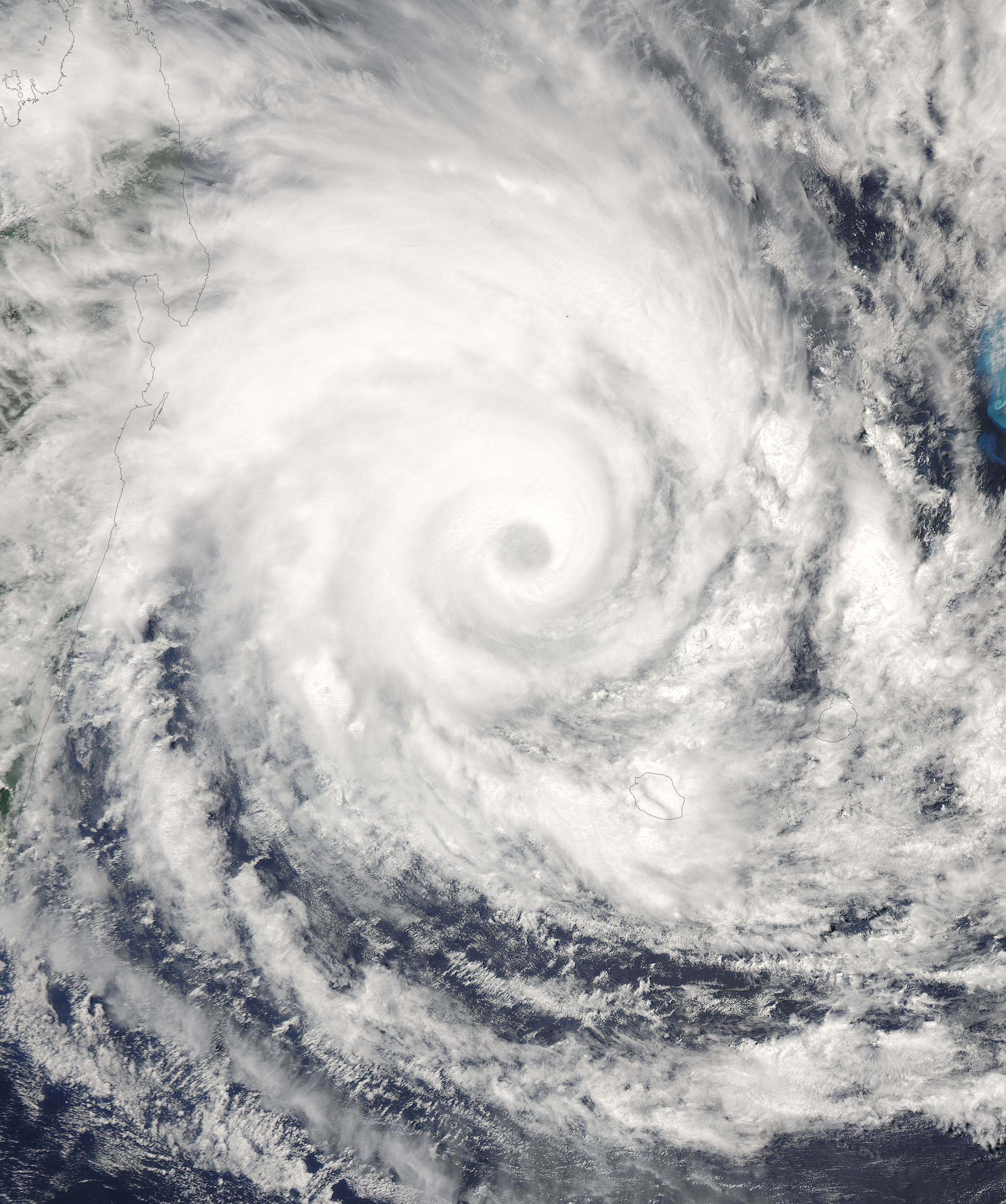
Tropical Cyclone Gamede was sitting in the western Indian Ocean off the shore of Madagascar on February 25, 2007. This powerful storm had been bringing heavy rains and strong surf to eastern Madagascar and the two major Mascarene Islands of Reunion and Mauritius. No settled land areas were experiencing the full brunt of of the sustained winds in the eyewall of the storm (reported at 195 kilometers per hour (120 miles per hour) by the Joint Typhoon Warning Center,) but damaging winds of 60 to 100 km/hr were recorded on the islands. One rainfall gauge measured totals as high as 47 centimeters over the three days Gamede was in the area, according to U.K. Accuweather.
This photo-like image was acquired by the Moderate Resolution Imaging Spectroradiometer (MODIS) on NASA’s Aqua satellite on February 25, 2007, at 11:50 a.m. local time (9:50 UTC), as the storm sat in the region between the small islands and Madagascar. At that time, it appeared the storm would head roughly south, bringing more winds and rain to the Mascarene Islands but not coming ashore onto Madagascar. Since the island had been pummeled by a series of tropical cyclones and storms in preceding months, Gamede was being watched with great care and concern by residents of the islands.
The image provided above is at 1 kilometer resolution, less than the full level of detail possible from the MODIS instrument. The MODIS Rapid Response System provides this image at additional resolutions. Their image collection also includes the distant, but neighboring Cyclone Humba in the central Indian Ocean.| Diese Datei ist gemeinfrei (public domain), da sie von der NASA erstellt worden ist. Die NASA-Urheberrechtsrichtlinie besagt, dass „NASA-Material nicht durch Urheberrecht geschützt ist, wenn es nicht anders angegeben ist“. (NASA-Urheberrechtsrichtlinie-Seite oder JPL Image Use Policy). | ||
 |
Warnung:
|


Relevante Bilder


Relevante Artikel
Zyklonsaison im Südwestindik 2006–2007Die Zyklonsaison im Südwestindik 2006–2007 begann am 15. November 2006 und endete am 30. April 2007, mit Ausnahme von Mauritius und den Seychellen, wo sie erst am 15. Mai endete. Diese Daten begrenzen konventionell den Zeitraum des meteorologischen Jahres auf der Südhalbkugel, in dem sich die meisten tropischen Wirbelstürme in diesem Becken bilden. Der Verantwortungsbereich des Regional Specialized Meteorological Centre La Réunion liegt westlich des 90. Grades östlicher Länge und südlich des Äquators. Durch das Joint Typhoon Warning Center (JTWC) in Honolulu werden für die US-amerikanischen Einrichtungen im Indischen Ozean eigenständige Warnungen und Prognosen ausgegeben. Durch das JTWC erfolgt die Einstufung nach der Saffir-Simpson-Hurrikan-Windskala, das RSMC wendet für die Einstufung eigene Kriterien an, denen unter anderem die Messung der andauernden Windgeschwindigkeit auf Basis einer zehnminütigen Beobachtung zugrunde liegt. .. weiterlesen