Crowsnest pass
![]() |
Es ist erlaubt, die Datei unter den Bedingungen der GNU-Lizenz für freie Dokumentation, Version 1.2 oder einer späteren Version, veröffentlicht von der Free Software Foundation, zu kopieren, zu verbreiten und/oder zu modifizieren; es gibt keine unveränderlichen Abschnitte, keinen vorderen und keinen hinteren Umschlagtext.
Der vollständige Text der Lizenz ist im Kapitel GNU-Lizenz für freie Dokumentation verfügbar. |
![]() ![]() ![]() |
Diese Datei ist unter der Creative-Commons-Lizenz „Namensnennung – Weitergabe unter gleichen Bedingungen 3.0 nicht portiert“ lizenziert. | |
| ||
Diese Lizenzmarkierung wurde auf Grund der GFDL-Lizenzaktualisierung hinzugefügt. |
Relevante Bilder
![](https://upload.wikimedia.org/wikipedia/commons/thumb/a/a4/Flag_of_the_United_States.svg/250px-Flag_of_the_United_States.svg.png)
![](https://upload.wikimedia.org/wikipedia/commons/thumb/b/b6/Canada_Alberta_relief_location_map.jpg/125px-Canada_Alberta_relief_location_map.jpg)
![](https://upload.wikimedia.org/wikipedia/commons/thumb/c/cf/Flag_of_Canada.svg/400px-Flag_of_Canada.svg.png)
![](https://upload.wikimedia.org/wikipedia/commons/thumb/5/54/CrowsnestMountainSummitView.jpg/250px-CrowsnestMountainSummitView.jpg)
![](https://upload.wikimedia.org/wikipedia/commons/thumb/7/71/Crowsnest_Mtn.jpg/250px-Crowsnest_Mtn.jpg)
![](https://upload.wikimedia.org/wikipedia/commons/thumb/4/48/Grossglockner_Hochalpenstrasse%2C_panoráma_észak_felé._Fortepan_57276.jpg/250px-Grossglockner_Hochalpenstrasse%2C_panoráma_észak_felé._Fortepan_57276.jpg)
![](https://upload.wikimedia.org/wikipedia/commons/thumb/b/b8/The_tiny_hamlet_named%2C_Brand_visible_down_in_the_shade_and_the_Otztal_with_nice_mountains_behind_-_panoramio.jpg/250px-The_tiny_hamlet_named%2C_Brand_visible_down_in_the_shade_and_the_Otztal_with_nice_mountains_behind_-_panoramio.jpg)
![](https://upload.wikimedia.org/wikipedia/commons/thumb/7/7f/Pfarrkirche_hl._Pankraz_%26_former_Mesnerhaus%2C_St._Pankraz%2C_Upper_Austria.jpg/250px-Pfarrkirche_hl._Pankraz_%26_former_Mesnerhaus%2C_St._Pankraz%2C_Upper_Austria.jpg)
![](https://upload.wikimedia.org/wikipedia/commons/thumb/1/13/Der_"Adler"_von_Sellrain_Tirol_%28Position_liegt_genau_auf_dem_Auge_des_Adlers%29_-_panoramio.jpg/250px-Der_"Adler"_von_Sellrain_Tirol_%28Position_liegt_genau_auf_dem_Auge_des_Adlers%29_-_panoramio.jpg)
![](https://upload.wikimedia.org/wikipedia/commons/thumb/5/5e/Prinz-Luitpold-Haus%2C_am_Anfang_des_Aufstieg_zum_Hochvogel_-_panoramio.jpg/250px-Prinz-Luitpold-Haus%2C_am_Anfang_des_Aufstieg_zum_Hochvogel_-_panoramio.jpg)
![](https://upload.wikimedia.org/wikipedia/commons/thumb/9/98/Die_Südwestflanke_des_Montagne_des_Agneaux_im_Écrins-Massiv_08130020.jpg/250px-Die_Südwestflanke_des_Montagne_des_Agneaux_im_Écrins-Massiv_08130020.jpg)
![](https://upload.wikimedia.org/wikipedia/commons/thumb/a/a5/02_2020_Grecia_photo_Paolo_Villa_FO199964_%28Ancona_Patrasso_traghetto_-_veduta_sulla_costa_albanese_greca_-_view_on_the_Albanian_Greek_coast%29.jpg/250px-02_2020_Grecia_photo_Paolo_Villa_FO199964_%28Ancona_Patrasso_traghetto_-_veduta_sulla_costa_albanese_greca_-_view_on_the_Albanian_Greek_coast%29.jpg)
![](https://upload.wikimedia.org/wikipedia/commons/thumb/5/50/Osoyoos_fruit.jpg/250px-Osoyoos_fruit.jpg)
![](https://upload.wikimedia.org/wikipedia/commons/thumb/c/c5/Glock_Horse_Performance_Center%2C_Show_Jumping%2C_Treffen_am_Ossiachersee%2C_Kärnten.jpg/250px-Glock_Horse_Performance_Center%2C_Show_Jumping%2C_Treffen_am_Ossiachersee%2C_Kärnten.jpg)
![](https://upload.wikimedia.org/wikipedia/commons/thumb/4/49/Fort_steele.jpg/250px-Fort_steele.jpg)
![](https://upload.wikimedia.org/wikipedia/commons/thumb/1/1d/Frank_Slide.jpg/250px-Frank_Slide.jpg)
![](https://upload.wikimedia.org/wikipedia/commons/thumb/d/d2/Fotothek_df_ps_0005192_Landschaften_^_Hügellandschaften_-_Gebirgslandschaften.jpg/250px-Fotothek_df_ps_0005192_Landschaften_^_Hügellandschaften_-_Gebirgslandschaften.jpg)
![](https://upload.wikimedia.org/wikipedia/commons/thumb/1/17/Cesta_v_korunách_stromů%2C_výhled_z_rozhledny_-_Neuschönau%2C_Německo_-_panoramio.jpg/250px-Cesta_v_korunách_stromů%2C_výhled_z_rozhledny_-_Neuschönau%2C_Německo_-_panoramio.jpg)
![](https://upload.wikimedia.org/wikipedia/commons/thumb/1/10/Zwieselbachtal_with_cross_above_the_Sweinfurterhutte_2029m_-_panoramio.jpg/250px-Zwieselbachtal_with_cross_above_the_Sweinfurterhutte_2029m_-_panoramio.jpg)
![](https://upload.wikimedia.org/wikipedia/commons/thumb/0/06/Fotothek_df_ps_0000985_001_Landschaften_^_Hügellandschaften_-_Gebirgslandschafte.jpg/125px-Fotothek_df_ps_0000985_001_Landschaften_^_Hügellandschaften_-_Gebirgslandschafte.jpg)
![](https://upload.wikimedia.org/wikipedia/commons/thumb/c/ce/Fotothek_df_ps_0005193_Landschaften_^_Hügellandschaften_-_Gebirgslandschaften.jpg/125px-Fotothek_df_ps_0005193_Landschaften_^_Hügellandschaften_-_Gebirgslandschaften.jpg)
![](https://upload.wikimedia.org/wikipedia/commons/thumb/b/b0/Fotothek_df_ps_0002080_Landschaften_^_Hügellandschaften_-_Gebirgslandschaften_^.jpg/125px-Fotothek_df_ps_0002080_Landschaften_^_Hügellandschaften_-_Gebirgslandschaften_^.jpg)
![](https://upload.wikimedia.org/wikipedia/commons/thumb/a/a0/Fotothek_df_ps_0001965_Landschaften_^_Hügellandschaften_-_Gebirgslandschaften.jpg/125px-Fotothek_df_ps_0001965_Landschaften_^_Hügellandschaften_-_Gebirgslandschaften.jpg)
![](https://upload.wikimedia.org/wikipedia/commons/thumb/0/02/Fotothek_df_ps_0002077_Landschaften_^_Hügellandschaften_-_Gebirgslandschaften_^.jpg/125px-Fotothek_df_ps_0002077_Landschaften_^_Hügellandschaften_-_Gebirgslandschaften_^.jpg)
![](https://upload.wikimedia.org/wikipedia/commons/thumb/a/a1/Fotothek_df_ps_0000982_Landschaften_^_Hügellandschaften_-_Gebirgslandschaften.jpg/250px-Fotothek_df_ps_0000982_Landschaften_^_Hügellandschaften_-_Gebirgslandschaften.jpg)
![](https://upload.wikimedia.org/wikipedia/commons/thumb/7/7c/Fotothek_df_ps_0002081_Landschaften_^_Hügellandschaften_-_Gebirgslandschaften_^.jpg/125px-Fotothek_df_ps_0002081_Landschaften_^_Hügellandschaften_-_Gebirgslandschaften_^.jpg)
![](https://upload.wikimedia.org/wikipedia/commons/thumb/d/d1/Fotothek_df_ps_0001967_Landschaften_^_Hügellandschaften_-_Gebirgslandschaften_^.jpg/125px-Fotothek_df_ps_0001967_Landschaften_^_Hügellandschaften_-_Gebirgslandschaften_^.jpg)
![](https://upload.wikimedia.org/wikipedia/commons/thumb/d/d3/Háttérben_a_hegyoldalban_a_Flexenstrasse._Fortepan_70223.jpg/250px-Háttérben_a_hegyoldalban_a_Flexenstrasse._Fortepan_70223.jpg)
![](https://upload.wikimedia.org/wikipedia/commons/thumb/9/95/ETH-BIB-Flug_Wien_-_Zürich_über_Grossglockner_-_Oetztal_-_Silvretta_-_Walensee-Weitere-LBS_MH02-10-0015.tif/lossy-page1-125px-ETH-BIB-Flug_Wien_-_Zürich_über_Grossglockner_-_Oetztal_-_Silvretta_-_Walensee-Weitere-LBS_MH02-10-0015.tif.jpg)
![](https://upload.wikimedia.org/wikipedia/commons/thumb/1/1d/Fotothek_df_ps_0001792_Bäume_^_Landschaften_^_Hügellandschaften_-_Gebirgslandsch.jpg/250px-Fotothek_df_ps_0001792_Bäume_^_Landschaften_^_Hügellandschaften_-_Gebirgslandsch.jpg)
![](https://upload.wikimedia.org/wikipedia/commons/thumb/4/48/ETH-BIB-Flug_Wien_-_Zürich_über_Grossglockner_-_Oetztal_-_Silvretta_-_Walensee-Weitere-LBS_MH02-10-0010.tif/lossy-page1-125px-ETH-BIB-Flug_Wien_-_Zürich_über_Grossglockner_-_Oetztal_-_Silvretta_-_Walensee-Weitere-LBS_MH02-10-0010.tif.jpg)
![](https://upload.wikimedia.org/wikipedia/commons/thumb/4/43/ETH-BIB-Sicht_auf_die_Österreichischen_Zentralalpen_bei_der_Besteigung_des_Grossglockners-Weitere-LBS_MH02-18-0034.tif/lossy-page1-125px-ETH-BIB-Sicht_auf_die_Österreichischen_Zentralalpen_bei_der_Besteigung_des_Grossglockners-Weitere-LBS_MH02-18-0034.tif.jpg)
![](https://upload.wikimedia.org/wikipedia/commons/thumb/f/f4/Fotothek_df_ps_0002075_Landschaften_^_Hügellandschaften_-_Gebirgslandschaften_^.jpg/125px-Fotothek_df_ps_0002075_Landschaften_^_Hügellandschaften_-_Gebirgslandschaften_^.jpg)
![](https://upload.wikimedia.org/wikipedia/commons/thumb/2/2d/Fotothek_df_ps_0004089_Landschaften_^_Hügellandschaften_-_Gebirgslandschaften.jpg/125px-Fotothek_df_ps_0004089_Landschaften_^_Hügellandschaften_-_Gebirgslandschaften.jpg)
![](https://upload.wikimedia.org/wikipedia/commons/thumb/c/c8/Fotothek_df_ps_0001968_Landschaften_^_Hügellandschaften_-_Gebirgslandschaften_^.jpg/125px-Fotothek_df_ps_0001968_Landschaften_^_Hügellandschaften_-_Gebirgslandschaften_^.jpg)
![](https://upload.wikimedia.org/wikipedia/commons/thumb/b/b8/Fotothek_df_ps_0000981_Landschaften_^_Hügellandschaften_-_Gebirgslandschaften.jpg/250px-Fotothek_df_ps_0000981_Landschaften_^_Hügellandschaften_-_Gebirgslandschaften.jpg)
![](https://upload.wikimedia.org/wikipedia/commons/thumb/7/7d/Fotothek_df_ps_0001913_Landschaften_^_Hügellandschaften_-_Gebirgslandschaften_^.jpg/125px-Fotothek_df_ps_0001913_Landschaften_^_Hügellandschaften_-_Gebirgslandschaften_^.jpg)
![](https://upload.wikimedia.org/wikipedia/commons/thumb/5/59/Fotothek_df_ps_0001976_Landschaften_^_Hügellandschaften_-_Gebirgslandschaften.jpg/125px-Fotothek_df_ps_0001976_Landschaften_^_Hügellandschaften_-_Gebirgslandschaften.jpg)
![](https://upload.wikimedia.org/wikipedia/commons/thumb/e/e5/Fotothek_df_ps_0002083_Landschaften_^_Hügellandschaften_-_Gebirgslandschaften_^.jpg/125px-Fotothek_df_ps_0002083_Landschaften_^_Hügellandschaften_-_Gebirgslandschaften_^.jpg)
![](https://upload.wikimedia.org/wikipedia/commons/thumb/1/1d/Fotothek_df_ps_0002079_Landschaften_^_Hügellandschaften_-_Gebirgslandschaften_^.jpg/125px-Fotothek_df_ps_0002079_Landschaften_^_Hügellandschaften_-_Gebirgslandschaften_^.jpg)
Relevante Artikel
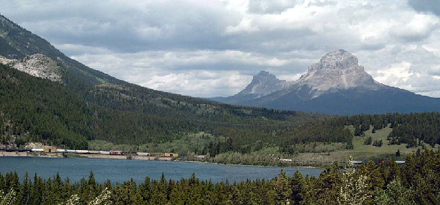
Crowsnest PassDer Crowsnest Pass ist der südlichste Gebirgspass in den kanadischen Rocky Mountains an der Grenze zwischen den Provinzen British Columbia und Alberta, unweit der Grenze zu den USA. Der 1356 m hohe Pass ist nach dem Crowsnest Mountain benannt, der seinen Namen von den in der Umgebung lebenden Cree-Indianern erhielt. 1898 wurde eine Zweigstrecke der Canadian Pacific Railway über den Pass gebaut, um die reichen Kohlevorkommen zu erschließen. Heute führen zusätzlich zur Bahnstrecke auch der Crowsnest Highway und eine Ölpipeline über den Pass. .. weiterlesen
Crowsnest MountainDer Crowsnest Mountain ist ein 2785 m hoher Berg in den kanadischen Rocky Mountains im Südwesten der Provinz Alberta. Er steht sehr isoliert und ist nur im Norden über einen Sattel mit seinen Nachbarn, den Seven Sisters, verbunden. Er liegt östlich der kontinentalen Wasserscheide zwischen Pazifik und Arktis. Unweit des Berges bietet der Crowsnest Pass einen Übergang über diese Wasserscheide, die zugleich Grenze der Provinzen Alberta und British Columbia ist; die Passstraße, der Highway 3, wird auf ihrer gesamten Strecke durch die Rocky Mountains als Crowsnest Highway bezeichnet. .. weiterlesen
Crowsnest HighwayDer Crowsnest Highway ist die südlichste der drei bedeutenden, neben dem Trans-Canada Highway und dem Yellowhead Highway, die Rocky Mountains in Kanada überquerenden Fernstraßen. Sowohl in Alberta als auch in British Columbia ist er als Highway 3 ausgewiesen. .. weiterlesen
Alberta Highway 3Der Alberta Highway 3, auch Crowsnest Highway genannt, ist eine Fernstraße in der kanadischen Provinz Alberta. Er führt von der Grenze zur westlichen Nachbarprovinz British Columbia am Crowsnest Pass zur Stadt Medicine Hat. Der Highway hat eine Länge von 324 km und ist dabei, als sogenannte Core Route, Bestandteil des kanadischen National Highway System. .. weiterlesen