Cape of Good Hope Iss059e078303 lrg, Diep River

Autor/Urheber:
The International Space Station Program supports the laboratory as part of the ISS National Lab to help astronauts take pictures of Earth that will be of the greatest value to scientists and the public, and to make those images freely available on the Internet. Additional images taken by astronauts and cosmonauts can be viewed at the NASA/JSC Gateway to Astronaut Photography of Earth. Caption by Sarah Deitrick, Jacobs-JETS Contract at NASA-JSC.
Shortlink:
Quelle:
Größe:
1608 x 1833 Pixel (814901 Bytes)
Beschreibung:
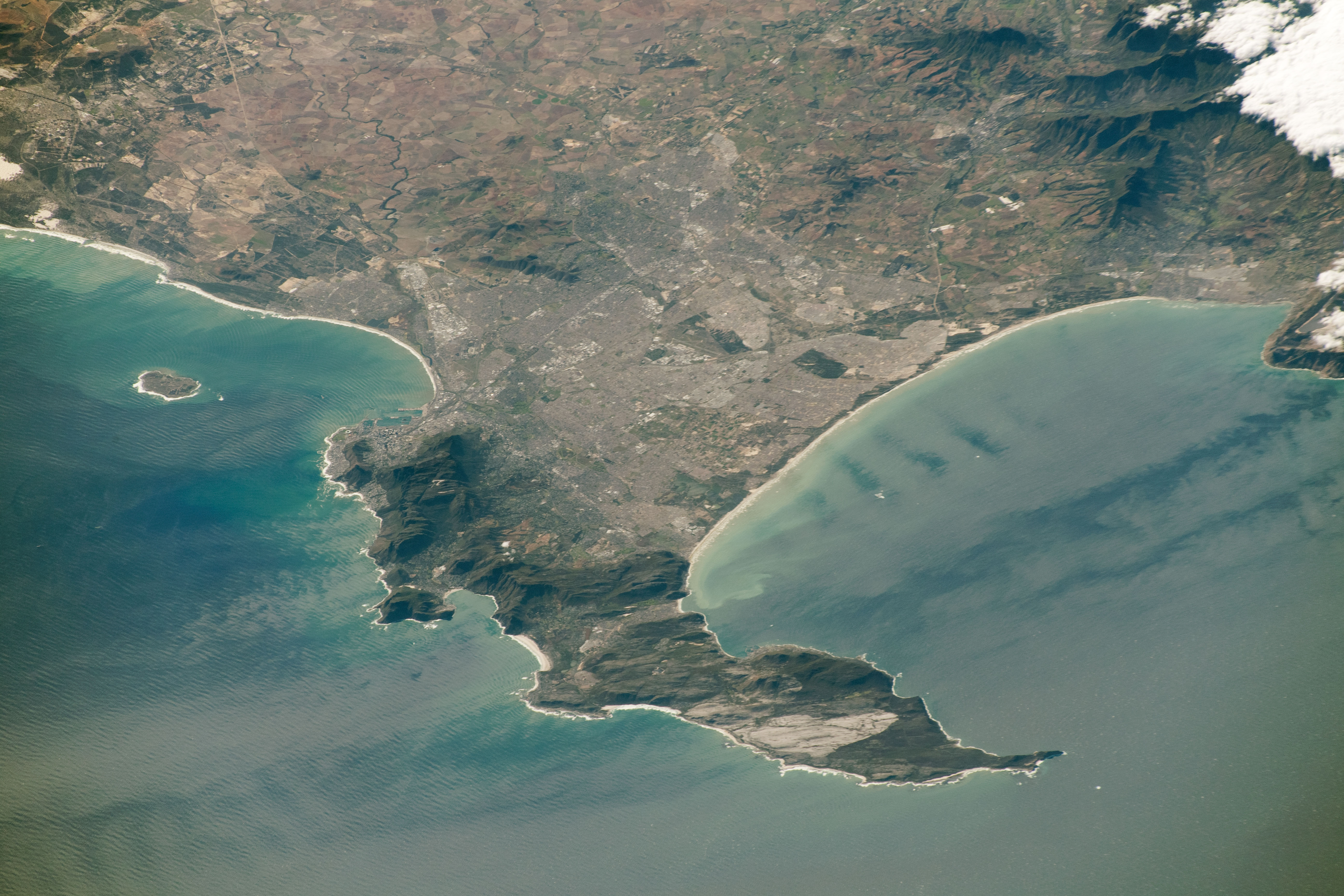
The course of the Diep River is clearly visible among wheat fields of the Swartland, Western Cape, South Africa. The N7 route and Old Malmesbury Road respectively form straight lines on the left and right sides of the river. The curved course of the Mosselbank River, a left bank tributary of the Diep, is also visible.
Astronaut photograph ISS059-E-78303 was acquired on May 28, 2019, with a Nikon D5 digital camera using a 340 millimeter lens and is provided by the ISS Crew Earth Observations Facility and the Earth Science and Remote Sensing Unit, Johnson Space Center. The image was taken by a member of the Expedition 59 crew.
Astronaut photograph ISS059-E-78303 was acquired on May 28, 2019, with a Nikon D5 digital camera using a 340 millimeter lens and is provided by the ISS Crew Earth Observations Facility and the Earth Science and Remote Sensing Unit, Johnson Space Center. The image was taken by a member of the Expedition 59 crew.
Lizenz:
Public domain
Bild teilen:


Relevante Bilder


Relevante Artikel
Diep RiverDer Diep River ist ein Fluss im Südwesten Südafrikas. .. weiterlesen