CHS - FAA airport diagram
Autor/Urheber:
Produced by the National Aeronautical Charting Office (NACO), a department of the Federal Aviation Administration (FAA).
Shortlink:
Quelle:
Größe:
651 x 1000 Pixel (184989 Bytes)
Beschreibung:
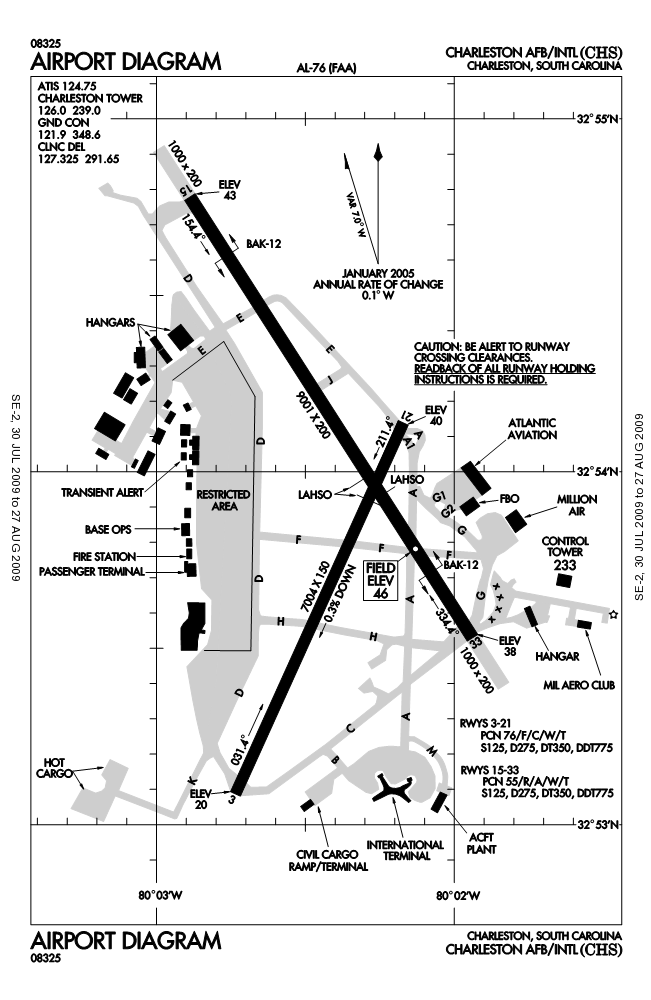
FAA airport diagram for Charleston International Airport (CHS) in North Charleston, South Carolina, United States.
Kommentar zur Lizenz:
This image or file is a work of a Federal Aviation Administration employee, taken or made as part of that person's official duties. As a work of the U.S. federal government, the image is in the public domain in the United States.
Lizenz:
Public domain
Credit:
http://naco.faa.gov/d-tpp/0908/00076AD.PDF
Note: this URL changes every 28 days; the airport article should contain a link to the current FAA diagram.
Note: this URL changes every 28 days; the airport article should contain a link to the current FAA diagram.
Bild teilen:


Relevante Bilder

Relevante Artikel
Flughafen CharlestonDer Flughafen Charleston ist der Flughafen der Stadt Charleston im US-Bundesstaat South Carolina. Im Rahmen einer 1952 auf Grund des Koreakriegs abgeschlossenen Vereinbarung, die 1973 erneuert wurde, nutzt die United States Air Force den Flughafen als Charleston Air Force Base auch für militärische Zwecke. .. weiterlesen