CEF map
Autor/Urheber:
P199
Shortlink:
Quelle:
Größe:
1984 x 1408 Pixel (932331 Bytes)
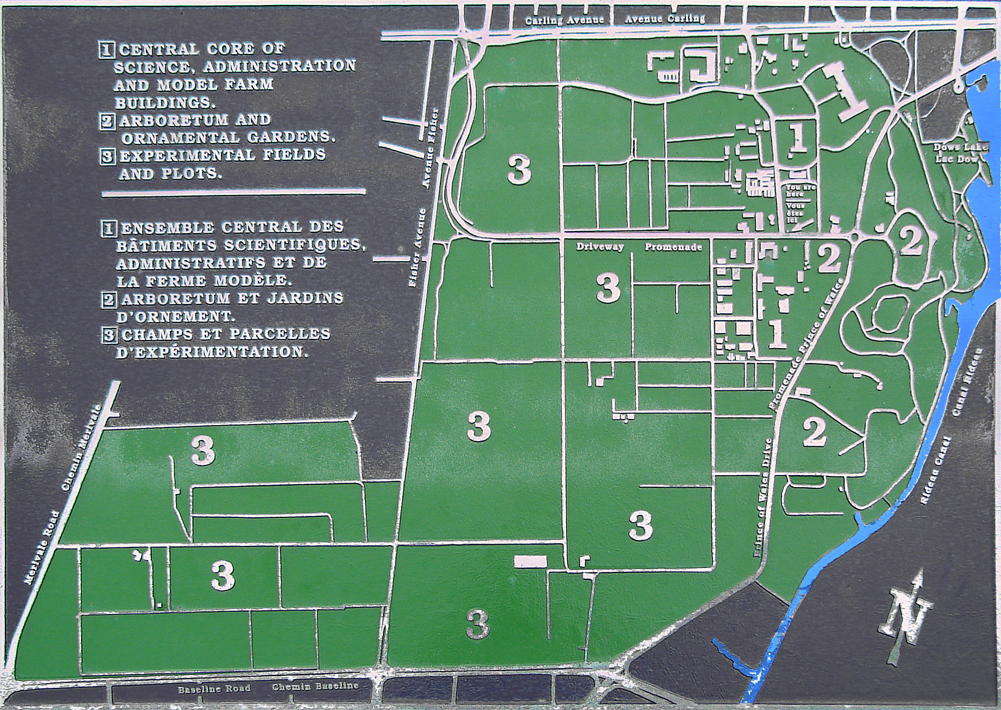
Beschreibung:
Map of Central Experimental Farm, Ottawa, Ontario, Canada
Kommentar zur Lizenz:
The photographical reproduction of this work is covered under s. 32.2(1)(b) of the Copyright Act (Canada), which states:
- 32.2 (1) It is not an infringement of copyright...
- (b) for any person to reproduce, in a painting, drawing, engraving, photograph or cinematographic work
- (i) an architectural work, provided the copy is not in the nature of an architectural drawing or plan, or
- (ii) a sculpture or work of artistic craftsmanship or a cast or model of a sculpture or work of artistic craftsmanship, that is permanently situated in a public place or building
Lizenz:
Public domain
Bild teilen:


Relevante Bilder


Relevante Artikel
Central Experimental Farm/Ferme expérimentale centraleDas englisch Central Experimental Farm und französisch Ferme expérimentale centrale genannte Institut ist ein Landwirtschaftliches Forschungsinstitut in der kanadischen Hauptstadt Ottawa. Die gesamte Anlage ist seit 1997 als nationale historische Stätte klassifiziert, darüber hinaus sind zahlreiche Gebäude der Farm individuell denkmalgeschützt. .. weiterlesen