CAK-Diagram
Autor/Urheber:
Shortlink:
Quelle:
Größe:
774 x 1189 Pixel (169808 Bytes)
Beschreibung:
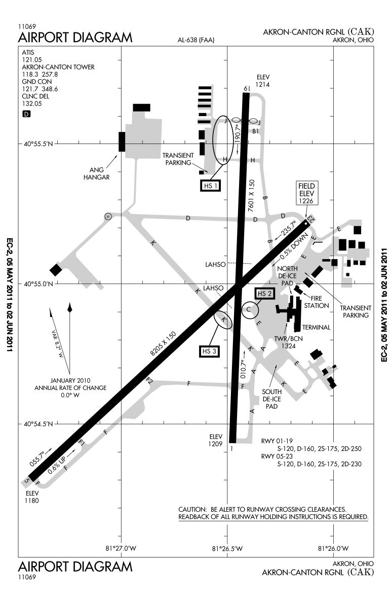
Higher resolution of the FAA diagram of en:Akron-Canton Regional Airport (CAK) in Akron, Ohio, converted from PDF format to PNG format by me, User:IanManka. Original PDF file
Note: this URL changes monthly; the airport article should contain a link to the current FAA diagram.
Produced by the National Aeronautical Charting Office (NACO), a department of the en:Federal Aviation Administration (FAA).
Kommentar zur Lizenz:
This image or file is a work of a Federal Aviation Administration employee, taken or made as part of that person's official duties. As a work of the U.S. federal government, the image is in the public domain in the United States.
Lizenz:
Public domain
Bild teilen:


Relevante Bilder

Relevante Artikel
Akron-Canton Regional AirportDer Akron-Canton Regional Airport ist der regionale Verkehrsflughafen der amerikanischen Städte Akron und Canton im US-Bundesstaat Ohio. .. weiterlesen