Buna-Gona map
| This image is in the public domain because it contains materials that originally came from the United States Army Center of Military History, subject to the following qualification.
Note: The images of all badges, insignia, decorations and medals on the "CMH Online" web site are produced by the United States Army Institute of Heraldry and protected by Title 18, United States Code, Section 704 and the Code of Federal Regulations (32 CFR, Part 507). Permission to use these images for commercial purposes must be obtained from The Institute of Heraldry prior to their use. |
 |
![[1]](http://www.history.army.mil/brochures/papua/papmap3.jpg)


Relevante Bilder


.svg)
.svg)


.svg)

Relevante Artikel
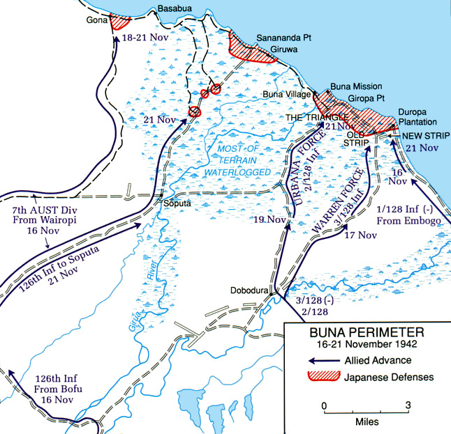
Schlacht um Buna-Gona-SananandaDie Schlacht um Buna-Gona-Sanananda war ein Konflikt im Pazifikkrieg während des Zweiten Weltkriegs zwischen japanischen und alliierten Truppen und fand vom 16. November 1942 bis zum 22. Januar 1943 im damaligen australisch verwalteten britischen Territorium Papua im Gebiet der Küstenorte Buna, Gona und Sanananda statt. .. weiterlesen