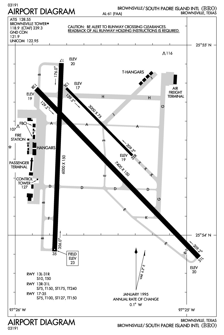
Brownsville Padre Island Airport Diagram - BRO from Federal Aviation Administration
Autor/Urheber:
uploaded by Johntex
Shortlink:
Quelle:
Größe:
754 x 1126 Pixel (186107 Bytes)
Beschreibung:
Photos and maps related to Padre Island.
Map of Brownsville - Padre Island Airport - Federal Aviation Administrations
Kommentar zur Lizenz:
Original work of the US Federal Government - public domain
Lizenz:
Public domain
Credit:
United States Government (USGS, Dept of Ag, NOAA, NPS, FAA)
Bild teilen:


Relevante Bilder


Relevante Artikel
Flughafen BrownsvilleDer Brownsville/South Padre Island International Airport ist ein öffentlicher Flughafen auf 7 m Seehöhe 8 km östlich von Brownsville, Texas, in den Vereinigten Staaten. Die Fläche des Flughafens beträgt 1200 ha. Er hat zwei Asphaltpisten mit 2255 m bzw. 1829 m Länge und jeweils 46 m Breite und eine Asphaltpiste mit 914 m Länge und 23 m Breite. .. weiterlesen