Broadgate and Precincts - geograph.org.uk - 554599
Größe:
640 x 480 Pixel (97903 Bytes)
Beschreibung:
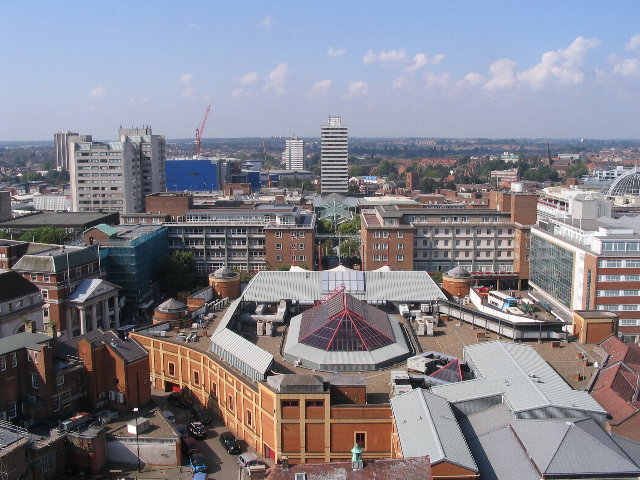
Broadgate and Precincts Taken from the tower of the old cathedral church of St. Michael, looking westwards down the line of the Upper and Lower Precinct shopping areas towards Mercia House[1], the tower block at the bottom end of the Lower Precinct. To the right of Mercia House is the red sandstone tower of St John's Church. To its left a little further into the distance is the Skydome and Odeon complex in Spon Street, partially obscured by the blue blob of Ikea. The grey tower block to the left is Coventry Point in Market Way. In the foreground is the roof of the Cathedral Lanes shopping centre swamping Broadgate. Left foreground is Pepper Lane, running towards High Street.
To see how it looked in 1975, see https://www.geograph.org.uk/photo/156892
and 1983 :
https://www.geograph.org.uk/photo/1059854 .
Weitere Informationen zur Lizenz des Bildes finden Sie hier. Letzte Aktualisierung: Fri, 26 Apr 2024 23:14:23 GMT
Relevante Bilder
Relevante Artikel
Coventry
Coventry [ˈkɒvəntɹɪ] ist eine englische Industriestadt im Metropolitan County der West Midlands, Vereinigtes Königreich. Sie bildet einen Metropolitan Borough und besitzt den Status einer City. Mit ca. 370.000 Einwohnern belegt Coventry auf der Liste der Städte im Vereinigten Königreich den elften Platz. Coventry liegt 153 Kilometer nordwestlich von London und 39 Kilometer östlich von Birmingham. Sie ist weiter als jede andere britische Stadt von der Küste entfernt.
.. weiterlesen


