Bridge(mcalister-crossing)(mueller-bridge)2016-3
Autor/Urheber:
Attribution:
Das Bild ist mit 'Attribution Required' markiert, aber es wurden keine Informationen über die Attribution bereitgestellt. Vermutlich wurde bei Verwendung des MediaWiki-Templates für die CC-BY Lizenzen der Parameter für die Attribution weggelassen. Autoren und Urheber finden für die korrekte Verwendung der Templates hier ein Beispiel.
Shortlink:
Quelle:
Größe:
1659 x 1106 Pixel (1344250 Bytes)
Beschreibung:
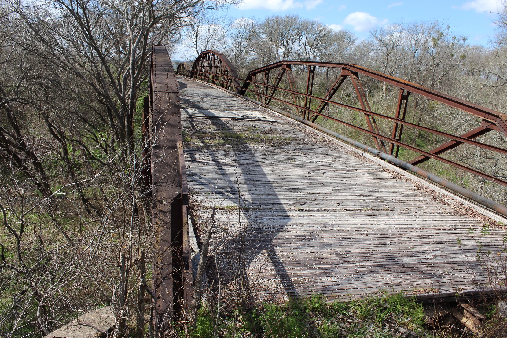
Bridge at McAlister Crossing (Mueller Bridge) (2/10 mi. SW). John Murphy McAlister (1807-1885) and his wife, Isabella (McClain) (1817-1872), settled in La Vernia with their family in the early 1850s. In 1857, they purchased several hundred acres of land on the southwest bank of Cibolo Creek. The natural stream crossing adjacent to their property became known as McAlister Crossing and for years served residents on both sides. The McAlister children subdivided the land following their father's death in 1885. About the same time, county commissioners designated the local route, including the crossing, as Road No. 62 (present County Road 337). In 1906, the Henry Mueller family purchased land on the east side of the creek; a son would later buy land on the west side, just southwest of McAlister Crossing. In 1908, county commissioners permitted the placement of telephone poles along the road and the creek crossing. In 1915, the Commissioners Court contracted with the Alamo Construction Company of San Antonio to erect five bridges in the county, including one at McAlister Crossing. The most expensive of the new structures, the bridge at McAlister Crossing, completed in 1915, cost nearly $9,000. Because members of the Mueller family owned property on either end of the bridge, it was often called Mueller Bridge. The three-span, 252-foot Mueller Bridge at McAlister Crossing features polygonal camelback trusses with multiple panels. For more than 70 years it served local residents, surviving Cibolo Creek's occasional raging waters. Closed to vehicular traffic in 1988, it remains a historic link to engineering designes of the early 20th century. Recorded Texas Historic Landmark - 2004 #13258
Lizenz:
Bild teilen:


Relevante Bilder

.jpg)

(mueller-bridge)2016-3.jpg?uselang=de)
Relevante Artikel
Liste der Einträge im National Register of Historic Places im Wilson County (Texas)Die Liste der Registered Historic Places im Wilson County führt alle Bauwerke und historischen Stätten im texanischen Wilson County auf, die in das National Register of Historic Places aufgenommen wurden. .. weiterlesen