Bremenium Befundplan 1902
Autor/Urheber:
Autor/-in unbekannt
Shortlink:
Quelle:
Größe:
588 x 630 Pixel (266718 Bytes)
Beschreibung:
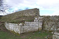
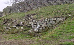
Plan of Bremenium' from 1902. It was an ancient Roman fort located at High Rochester, Northumberland, England. The fort was one of the defensive structures built along Dere Street, a Roman road running from York to Corbridge and onwards to Melrose.
Lizenz:
Public domain
Credit:
From Social England, edited by H.D. Traill, D.C.L. and J. S. Mann, M.A. Cassell and Company, Limited, London, Paris, New York & Melbourne, 1902
Relevante Bilder


(c) John Watson, CC BY-SA 2.0

(c) John Watson, CC BY-SA 2.0


(c) Oliver Dixon, CC BY-SA 2.0

(c) Classical Numismatic Group, Inc. http://www.cngcoins.com, CC BY-SA 3.0


(c) Pete Saunders, CC BY-SA 2.0


(c) John Watson, CC BY-SA 2.0

(c) Peter McDermott, CC BY-SA 2.0


Relevante Artikel
Kastell BremeniumBremenium war ein römisches Hilfstruppenkastell auf dem Gebiet der Gemeinde (Parish) Rochester, County Northumberland, England. .. weiterlesen
