Borneo fires October 2006
Autor/Urheber:
NASA image by Jeff Schmaltz, MODIS Rapid Response Team.
Shortlink:
Quelle:
Größe:
4000 x 3000 Pixel (2034972 Bytes)
Beschreibung:
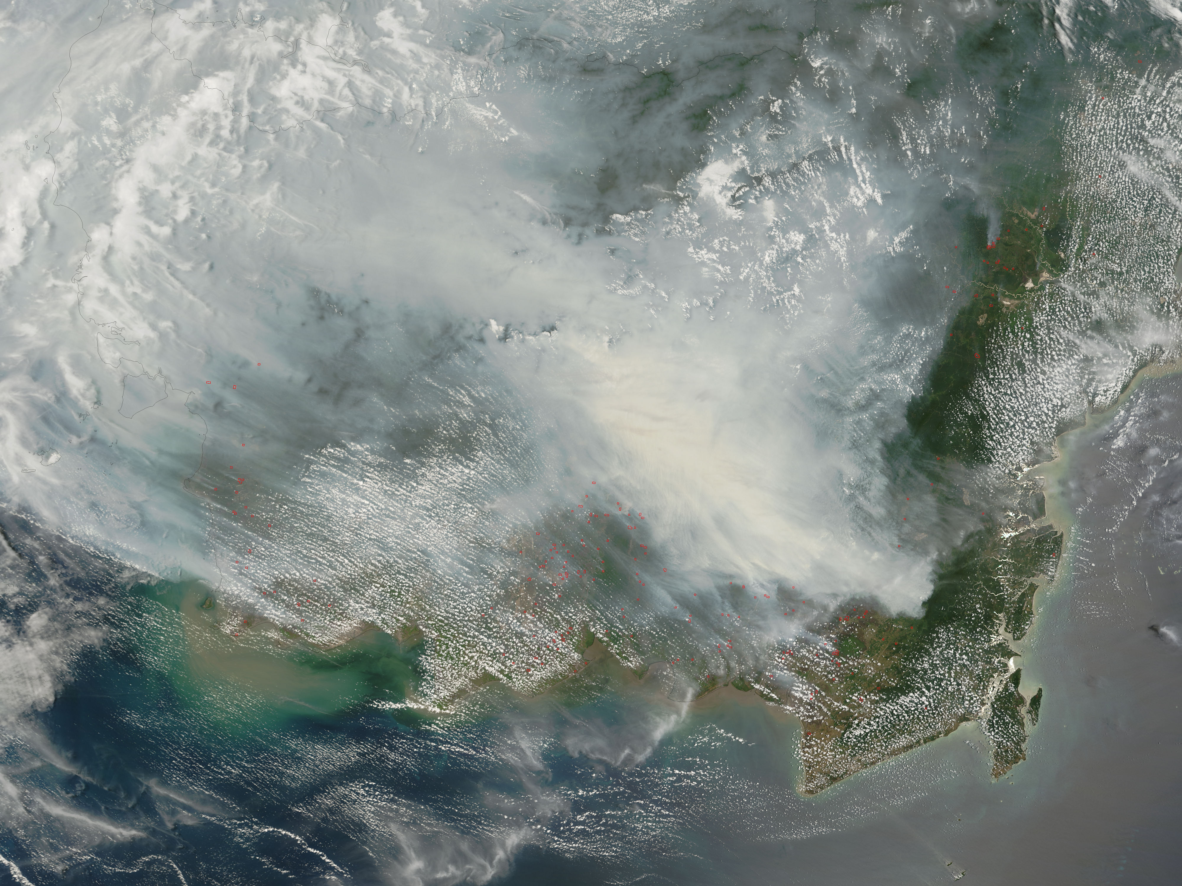
Fires on Borneo
Thick smoke hung over the island of Borneo when the Moderate Resolution Imaging Spectroradiometer (MODIS) on NASA’s Terra satellite passed overhead on October 5, 2006. The sensor detected scores of fires (locations marked in red) in the Kalimantan province of Indonesia, and smoke billowed northward over the Malaysian part of the island, as well. The fires occur annually in the dry season (August-October), caused mainly by land-clearing and other agricultural fires. Fires escape control and burn into forests and peat-swamp areas. Fires in peat—thick layers of dead, but un-decayed vegetation—are extremely smoky and difficult to put out. Some of the blazes will only be extinguished when the monsoon rains start in upcoming weeks.
Kommentar zur Lizenz:
| Diese Datei ist gemeinfrei (public domain), da sie von der NASA erstellt worden ist. Die NASA-Urheberrechtsrichtlinie besagt, dass „NASA-Material nicht durch Urheberrecht geschützt ist, wenn es nicht anders angegeben ist“. (NASA-Urheberrechtsrichtlinie-Seite oder JPL Image Use Policy). |
|
|
 |
Warnung:
|
Lizenz:
Public domain
Bild teilen:


Relevante Bilder


.jpg)
Relevante Artikel
Torfmoorwälder von BorneoDie Torfmoorwälder von Borneo sind eine Pflanzenformation des tropischen Regenwaldes, die auf der Insel Borneo in den Ländern Brunei, Indonesien und Malaysia existiert. .. weiterlesen