Boone-06own-map
Autor/Urheber:
webpage cites Author as Lands Staff.
Shortlink:
Quelle:
Größe:
580 x 740 Pixel (246845 Bytes)
Beschreibung:
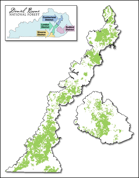
Map of Daniel Boone National Forest showing proclamation boundary and lands actually owned by the Forest Service, as of March 15, 2006. Inset map shows ranger districts.
Kommentar zur Lizenz:
http://www.fs.fed.us/privacy.shtml states: Information presented on this website is considered public information and may be distributed or copied unless otherwise indicated. Use of appropriate byline/photo/image credit is requested.
Lizenz:
Public domain
Bild teilen:


Relevante Bilder

Relevante Artikel
Daniel Boone National ForestDer Daniel Boone National Forest ist ein unter der Verwaltung des United States Forest Service stehender Nationalforst im östlichen Teil des US-Bundesstaats Kentucky. Er hat eine Gesamtfläche von zirka 2800 km² und umfasst damit rund fünf Prozent von Kentuckys Waldfläche. Das Waldgebiet erstreckt sich über 21 Countys des Staates; von Rowan County im Norden bis McCreary County im Süden. Die zum Daniel Boone National Forest gehörenden Ländereien befinden sich zum Teil in staatlichen, zum Teil in privatem Besitz. .. weiterlesen