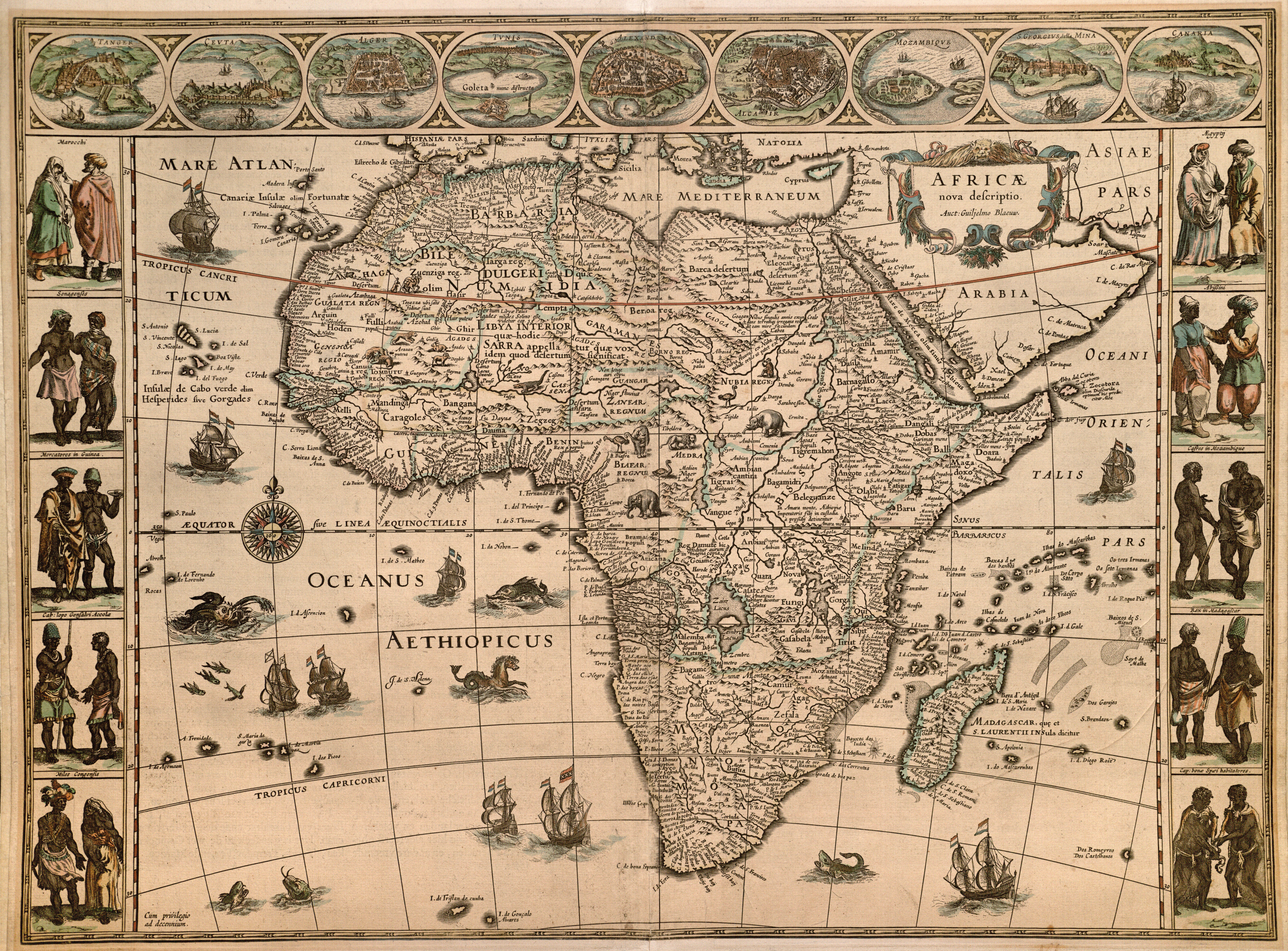
Africae Nova Descriptio
Autor/Urheber:
Shortlink:
Quelle:
Größe:
6810 x 5031 Pixel (17236469 Bytes)
Beschreibung:
Among the more important cartographers and map publishers of the Dutch Baroque or Golden Age, Willem Jansz. Blaeu (1571-1638), along with his sons Joan (ca.1599-1673) and Cornelis (1610-1644), created highly sought-for maps, atlases, and globes of considerable artistic refinement. A former pupil of the Danish astronomer Tycho Brahe, Willem based this map indirectly on Hondius' 1606 map of Africa which had been a source for his own landmark 1608 wall map of Africa (engraved by Josua van den Ende) which in turn served as a model for many other competitors. Around the border Blaeu has added illustrations of Tangier, Ceuta, Algiers, Tunis, Alexandria, Cairo, Mozambique, Elmina, and the Canary Islands. The figures in traditional dress include Moroccans, Senegalese, merchants in Guinea, inhabitants of Cabo Lopo Goncalves, Congolese warriors, Egyptians, Abyssinians, Kaffirs in Mozambique, the king of Madagascar and the inhabitants of the Cape of Good Hope. Blaeu's maps also introduced many more animals, sea monsters, and ships (most of them Dutch). Incidentally, one of the designers of the wall map had been Hessel Gerritsz, who served from 1617 as the official cartographer for the Dutch East India Company (VOC) until his death in 1632, when Willem took over, serving in that capacity until his death six years later. Willem's son Joan and grandson Joan II also served in this position, but the VOC also patronized their lesser-priced competitors.
Lizenz:
Public domain
Bild teilen:


Relevante Bilder
_UTA.jpg)


Relevante Artikel
Willem BlaeuWillem Janszoon Blaeu war ein niederländischer Kartograf und Verleger. .. weiterlesen