Bimini island
Autor/Urheber:
Original picture by NASA
Shortlink:
Quelle:
Größe:
5264 x 5264 Pixel (8878613 Bytes)
Beschreibung:
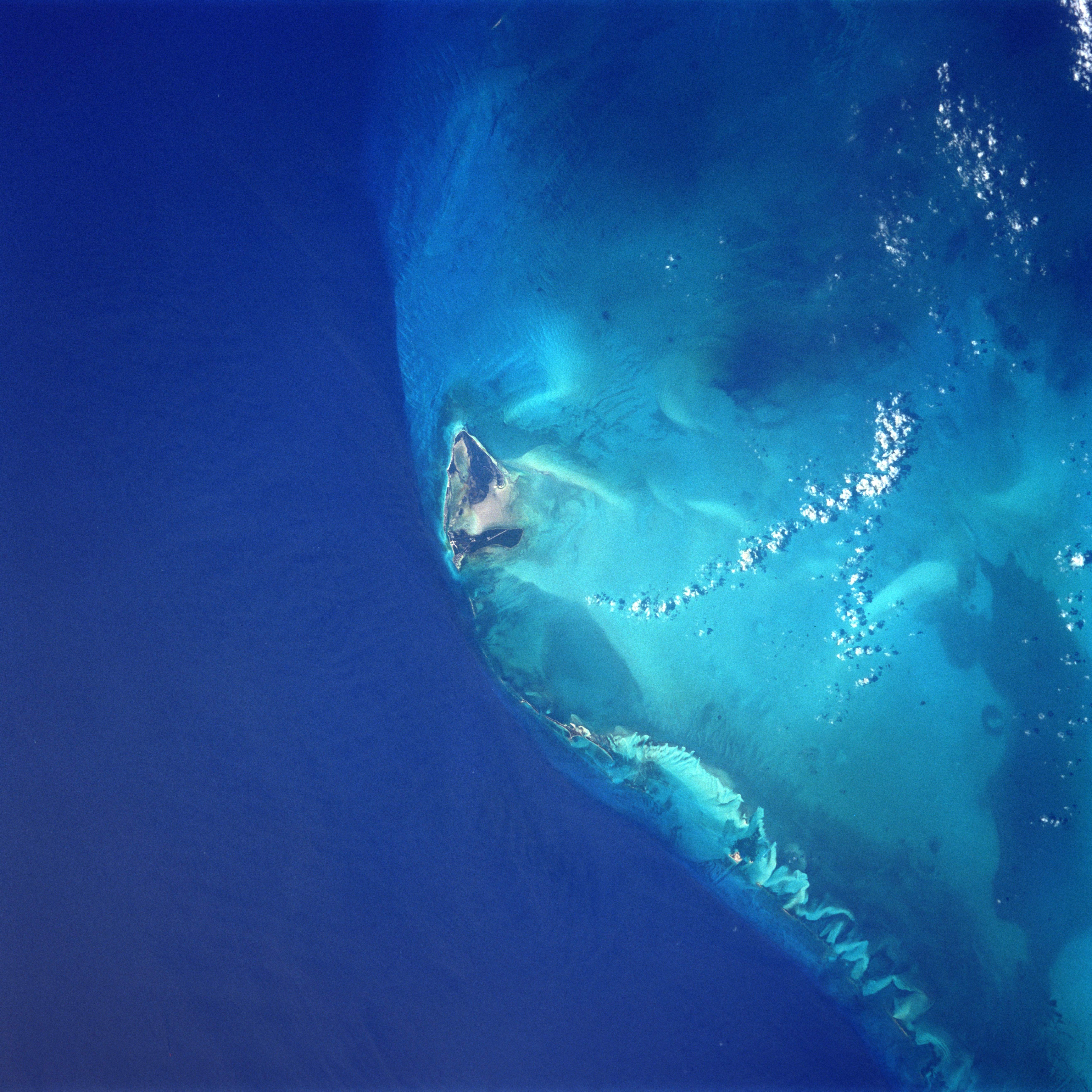
Bimini Island, Bahama Islands - June 1998
- The westernmost and closest to the United States mainland, the island of Bimini can be seen in this south-southwest-looking view. The two small islands that make up Bimini cover a total area of 9 sq. miles (23 sq. km). The waters surrounding Bimini are known for their excellent fishing. Bimini resembles an idyllic South Pacific atoll with a blue lagoon nearly enclosed by the two small islands. The island was named for the mythical island of Bimini, supposed site of the "Fountain of Youth", the quest for which led to the discovery of Florida in 1513 by Ponce De Leon.
Lizenz:
Public domain
Bild teilen:


Relevante Bilder


Relevante Artikel
Bimini (Bahamas)Bimini IPA: [ˈbɪmɪniː] ist eine Inselgruppe und ein Distrikt der Bahamas. Zum Distrikt gehört neben der Inselgruppe auch die Cay Sal Bank. Hauptinseln sind Nord-Bimini und Süd-Bimini. Nord-Bimini ist rund 11 km lang und 210 m breit, der Hauptort ist Alice Town, eine Ansammlung von Geschäften, Restaurants und Bars, die an einer Straße liegen. Auf Süd-Bimini sind nur eine Landebahn und zwei Hotels, diese Insel bietet daher eine ruhige Alternative zum regen Treiben auf Nord-Bimini. .. weiterlesen